|
search place name
|
||
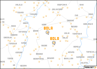
Bola (Bomi, Liberia)Bola is a town in the Bomi region of Liberia. An overview map of the region around Bola is displayed below.
regional and 3d topo map of Bola, Liberia ::
Bola airports ::
The nearest airport is MLW - Monrovia Spriggs Payne, located 74.7 km south of Bola.
Other airports nearby include ROB - Monrovia Roberts Intl (97.3 km south east), Nearby towns ::
Doba (3.1km north west) //
Gbaamu (4.3km west) //
Dasalamu (4.7km south) //
Bola (4.7km south east) //
Baima (4.8km west) //
Be Tape (5.1km south east) //
Be Gibson (5.5km east) //
Bugbe (5.6km south) //
Barmo (5.9km south west) //
Tawafia (6.2km north east) //
Dusa Number One (6.4km north east) //
Be Mawi (6.5km south east) //
Kaba Senod (7.0km north) //
Malia (7.0km east) //
Mabue Number Two (7.2km north) //
Kalia (7.3km east) //
Gbalakpa (7.5km south west) //
Be Momo Saki (7.5km west) //
Besaki (7.6km west) //
Be Reeves (7.7km east) //
Bando (8.2km north east) //
Sacky Town (8.3km west) //
Moba (8.4km south west) //
Ville Town (8.6km north east) //
Cannon Hill Town (8.7km east) //
Be Johnson (8.8km north) //
Ting Doa (8.8km north west) //
Gbeni (9.2km west) //
Bogbue (9.3km south) //
[all distances 'as the bird flies' and approximate]  Places with similar names to Bola, Liberia ::
Disclaimer :: Information on this page comes without warranty of any kind |
||
|
Where is Bola? Elevation and coordinates ::
Latitude (lat): 6°57'21"N Longitude (lon): 10°51'57"W
Elevation (approx.): 105m (map arrows pan, magnifying glasses zoom) |
||
|
Visiting Bola? Hotel/Accommodation ::
Book a hotel in Bola Travel Guide ::
Buy a travel guide for Liberia rental cars ::
car rental offers GPS waypoint ::
download a GPX waypoint (PoI) of Bola for your GPS receiver
|
||