|
search place name
|
||
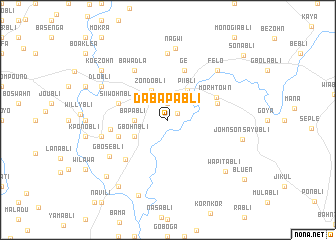
Dabapabli (Grand Bassa, Liberia)Dabapabli is a town in the Grand Bassa region of Liberia. An overview map of the region around Dabapabli is displayed below.
regional and 3d topo map of Dabapabli, Liberia ::
Dabapabli airports ::
The nearest airport is ROB - Monrovia Roberts Intl, located 82.8 km west of Dabapabli.
Other airports nearby include MLW - Monrovia Spriggs Payne (127.0 km west), Nearby towns ::
Pee Town (1.3km north east) //
Madingo (1.9km north) //
Ziangbainda (1.9km north) //
Bapabli (3.7km west) //
Zondobli (3.8km north west) //
Piibli (4.0km north east) //
Gaiyubli (4.1km south west) //
Gbohnbli (4.1km south west) //
Siiwohnbli (5.8km west) //
Ge (5.9km north) //
Monbli (5.8km east) //
Jaje (5.8km west) //
Lubli (5.8km west) //
Morh Town (6.0km north east) //
Fubli (6.4km south west) //
Bulgbo (6.4km west) //
Bawadla (6.7km north west) //
Jampakohn (7.4km north) //
Joy (7.6km west) //
Gbosebli (7.7km south west) //
Felo (7.8km north east) //
Nagwi (8.0km north) //
Dlobli (8.3km north west) //
Johnson Sayubli (8.6km east) //
Wapitabli (8.6km south east) //
Malasenio (9.0km south) //
Koezohn (9.2km north west) //
Margaretbli (9.2km south west) //
Sagatabli (9.3km south west) //
[all distances 'as the bird flies' and approximate] 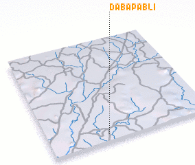 Places with similar names to Dabapabli, Liberia :: Disclaimer :: Information on this page comes without warranty of any kind |
||
|
Where is Dabapabli? Elevation and coordinates ::
Latitude (lat): 6°4'0"N Longitude (lon): 9°38'0"W
Elevation (approx.): 100m (map arrows pan, magnifying glasses zoom) |
||
|
Visiting Dabapabli? Hotel/Accommodation ::
Book a hotel in Dabapabli Travel Guide ::
Buy a travel guide for Liberia rental cars ::
car rental offers GPS waypoint ::
download a GPX waypoint (PoI) of Dabapabli for your GPS receiver
|
||