|
search place name
|
||
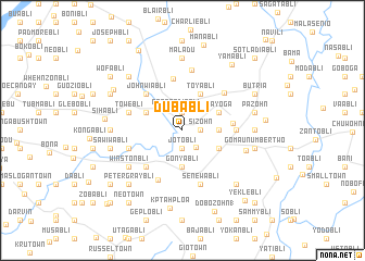
Dubabli (Grand Bassa, Liberia)Dubabli is a town in the Grand Bassa region of Liberia. An overview map of the region around Dubabli is displayed below.
regional and 3d topo map of Dubabli, Liberia ::
Dubabli airports ::
The nearest airport is ROB - Monrovia Roberts Intl, located 74.0 km north west of Dubabli.
Other airports nearby include MLW - Monrovia Spriggs Payne (116.2 km west), Nearby towns ::
Sizohn (1.8km east) //
Famobli (1.9km north) //
Jotobli (1.9km south) //
George Diobli (2.2km north) //
Goniabli (2.3km south east) //
Gonyabli (3.7km south) //
Dakui (3.7km south) //
Pobogle (3.7km east) //
Toyabli (4.1km north east) //
Mayoga (4.1km north east) //
Bawebli (4.1km south east) //
Peterbli (4.1km north west) //
Dabebli (5.2km east) //
John Wiabli (5.2km north west) //
Hon (5.2km south west) //
Nadee Geezaye (5.4km north) //
Pomoble (5.5km east) //
Joe Johnnybli (5.7km south west) //
Bowibli (5.7km north east) //
Senewabli (5.9km south) //
Gogabli (5.8km west) //
Dagabli (5.8km west) //
Towebli (5.8km west) //
Gagabli (6.3km north) //
Winstonbli (6.7km south west) //
Gomau (6.8km east) //
George David Farm (7.4km east) //
Jimbli (7.4km west) //
Maladu (7.4km north) //
[all distances 'as the bird flies' and approximate] 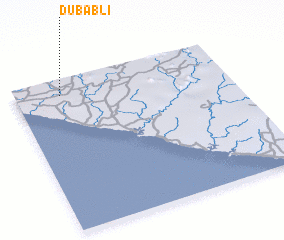 Places with similar names to Dubabli, Liberia ::
Disclaimer :: Information on this page comes without warranty of any kind |
||
|
Where is Dubabli? Elevation and coordinates ::
Latitude (lat): 5°54'0"N Longitude (lon): 9°47'0"W
Elevation (approx.): 57m (map arrows pan, magnifying glasses zoom) |
||
|
Visiting Dubabli? Hotel/Accommodation ::
Book a hotel in Dubabli Travel Guide ::
Buy a travel guide for Liberia rental cars ::
car rental offers GPS waypoint ::
download a GPX waypoint (PoI) of Dubabli for your GPS receiver
|
||