|
search place name
|
||
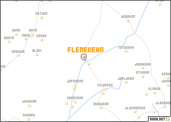
Flenekehn (Grand Kru, Liberia)Flenekehn is a town in the Grand Kru region of Liberia. An overview map of the region around Flenekehn is displayed below.
regional and 3d topo map of Flenekehn, Liberia ::
Flenekehn airports ::
The nearest airport is SPY - San Pedro, located 170.4 km east of Flenekehn.
Nearby towns ::
 Places with similar names to Flenekehn, Liberia ::
// Volynkina (RU)
// Volynkina (RU)
// Volynkino (RU)
// Phalangan (MM)
// Phalangon (MM)
// Flanagan (US)
// Flanagan (US)
// Flanigan (US)
// Velānganni (IN)
// Falink Kaïna (NE)
Disclaimer :: Information on this page comes without warranty of any kind |
||
|
Where is Flenekehn? Elevation and coordinates ::
Latitude (lat): 4°45'52"N Longitude (lon): 8°11'49"W
Elevation (approx.): 26m (map arrows pan, magnifying glasses zoom) |
||
|
Visiting Flenekehn? Hotel/Accommodation ::
Book a hotel in Flenekehn Travel Guide ::
Buy a travel guide for Liberia rental cars ::
car rental offers GPS waypoint ::
download a GPX waypoint (PoI) of Flenekehn for your GPS receiver
|
||