|
search place name
|
||
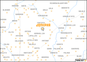
Jonkpha (Margibi, Liberia)Jonkpha is a town in the Margibi region of Liberia. An overview map of the region around Jonkpha is displayed below.
regional and 3d topo map of Jonkpha, Liberia ::
Jonkpha airports ::
The nearest airport is ROB - Monrovia Roberts Intl, located 50.5 km south of Jonkpha.
Other airports nearby include MLW - Monrovia Spriggs Payne (70.1 km south west), Nearby towns ::
Dwanta (2.6km north) //
Tabitata (2.6km north) //
Damamu (2.6km north west) //
Konakolleh (2.7km south west) //
Boketa (2.8km east) //
Jeaneta (3.4km south east) //
Weala (3.6km east) //
Boata (3.6km north east) //
Shangata (4.2km south east) //
Nyafokole (5.1km north east) //
Gulpeyeta (5.3km west) //
Lafellae (5.4km south west) //
Via Town (5.4km south) //
Kwalakoma (5.5km north) //
Blakuala (6.3km north east) //
Simpson (6.5km south) //
Vatege (6.6km west) //
Latell Farm (6.8km south west) //
Varteketa (6.9km west) //
Nienka (7.8km east) //
Waila (8.0km north) //
Gboryormu (8.0km north) //
Hicking Camp (8.2km south west) //
Wolaila (8.3km south west) //
Kombi Farm (8.9km north west) //
Halls Farm (8.9km north west) //
Senta (8.9km south) //
Gomai (9.2km south) //
Buchanan Camp (9.2km south) //
[all distances 'as the bird flies' and approximate]  Places with similar names to Jonkpha, Liberia ::
Disclaimer :: Information on this page comes without warranty of any kind |
||
|
Where is Jonkpha? Elevation and coordinates ::
Latitude (lat): 6°40'43"N Longitude (lon): 10°15'30"W
Elevation (approx.): 100m (map arrows pan, magnifying glasses zoom) |
||
|
Visiting Jonkpha? Hotel/Accommodation ::
Book a hotel in Jonkpha Travel Guide ::
Buy a travel guide for Liberia rental cars ::
car rental offers GPS waypoint ::
download a GPX waypoint (PoI) of Jonkpha for your GPS receiver
|
||