|
search place name
|
||
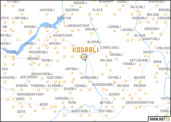
Kodabli (Grand Bassa, Liberia)Kodabli is a town in the Grand Bassa region of Liberia. An overview map of the region around Kodabli is displayed below.
regional and 3d topo map of Kodabli, Liberia ::
Kodabli airports ::
The nearest airport is ROB - Monrovia Roberts Intl, located 66.2 km north west of Kodabli.
Other airports nearby include MLW - Monrovia Spriggs Payne (109.2 km west), Nearby towns ::
Debabli (1.5km north west) //
Mesonbli (2.8km south) //
Josephbli (3.1km west) //
African Jordan (3.1km north) //
Gboligia (3.1km north) //
Blairbli (3.8km north east) //
Wofabli (3.9km south west) //
Suati (3.9km north east) //
Flahn Town (4.5km north west) //
John Wiabli (4.5km south) //
Maladu (4.6km east) //
Nadee Geezaye (4.6km south east) //
Waijo (4.6km east) //
Ruteya (4.6km east) //
Membibli (4.8km south west) //
Joabli (4.9km west) //
Nepabli (4.9km west) //
Temabli (5.3km south west) //
Woababli (5.6km north west) //
Charliebli (5.7km east) //
Gagabli (5.8km east) //
Magibli (6.2km north) //
Desebli (6.2km west) //
Peterbli (6.4km south) //
Towebli (6.4km south) //
Gogabli (6.4km south) //
Folebli (6.4km west) //
Engla Mission (6.5km south west) //
Manabli (6.7km east) //
[all distances 'as the bird flies' and approximate] 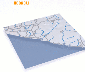 Places with similar names to Kodabli, Liberia ::
// Catabla (PH)
// Kedai Bual (MY)
// Kodobol (RU)
// Kātbaola (BD)
// Godbila (BF)
// Koudouboul (TD)
// Kitobola (CD)
// Kutabuloh (ID)
// Kutabuluh (ID)
// Ktay-Bala (UZ)
Disclaimer :: Information on this page comes without warranty of any kind |
||
|
Where is Kodabli? Elevation and coordinates ::
Latitude (lat): 5°58'25"N Longitude (lon): 9°49'26"W
Elevation (approx.): 69m (map arrows pan, magnifying glasses zoom) |
||
|
Visiting Kodabli? Hotel/Accommodation ::
Book a hotel in Kodabli Travel Guide ::
Buy a travel guide for Liberia rental cars ::
car rental offers GPS waypoint ::
download a GPX waypoint (PoI) of Kodabli for your GPS receiver
|
||