|
search place name
|
||
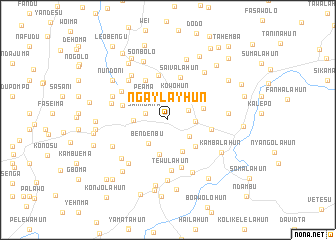
Ngaylayhun (Lofa, Liberia)Ngaylayhun is a town in the Lofa region of Liberia. An overview map of the region around Ngaylayhun is displayed below.
regional and 3d topo map of Ngaylayhun, Liberia ::
Ngaylayhun airports ::
The nearest airport is FAA - Faranah, located 204.0 km north of Ngaylayhun.
Nearby towns ::
Kotuhun (2.5km north east) //
Sahngana (2.6km west) //
Kowohun (2.9km north) //
Mawulahun (3.0km south east) //
Mbabahun (3.1km east) //
Bendenbu (3.4km south west) //
Ngohunba (3.5km north east) //
Kapi (3.6km north west) //
Peama (3.6km north west) //
Sosomolahun (3.8km south east) //
Kondobego (3.9km west) //
Gelema (4.0km south) //
Faihensu (4.0km north east) //
Wokoihun (4.2km east) //
Tingawa (4.2km south east) //
Saivalahun (4.9km north) //
Molahun (5.0km east) //
Fasama (5.1km north) //
Bandila (5.1km north west) //
Wodu (5.3km west) //
Nokole (5.5km south) //
Tewulahun (5.6km south) //
Foya Lundu (6.1km north west) //
Kangumba (6.2km north west) //
Kpormubu (6.4km north west) //
Yengbelahun (6.5km south east) //
Sakpawa (6.5km south west) //
Keya Bendu (6.5km west) //
Koyadu (6.7km south west) //
[all distances 'as the bird flies' and approximate]  Places with similar names to Ngaylayhun, Liberia ::
// Ngolahun (LR)
// Naiagolehun (SL)
// Naiagolehun (SL)
// Naiagolehun (SL)
// Naiagolehun (SL)
// Naiagolehun (SL)
// Naiagolehun (SL)
// Naiagolehun (SL)
// Naiagolehun (SL)
// Naiagolehun (SL)
Disclaimer :: Information on this page comes without warranty of any kind |
||
|
Where is Ngaylayhun? Elevation and coordinates ::
Latitude (lat): 8°17'36"N Longitude (lon): 10°9'38"W
Elevation (approx.): 548m (map arrows pan, magnifying glasses zoom) |
||
|
Visiting Ngaylayhun? Hotel/Accommodation ::
Book a hotel in Ngaylayhun Travel Guide ::
Buy a travel guide for Liberia rental cars ::
car rental offers GPS waypoint ::
download a GPX waypoint (PoI) of Ngaylayhun for your GPS receiver
|
||