|
search place name
|
||
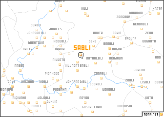
Sabli (Grand Bassa, Liberia)Sabli is a town in the Grand Bassa region of Liberia. An overview map of the region around Sabli is displayed below.
regional and 3d topo map of Sabli, Liberia ::
Sabli airports ::
The nearest airport is ROB - Monrovia Roberts Intl, located 24.0 km south west of Sabli.
Other airports nearby include MLW - Monrovia Spriggs Payne (65.0 km west), Nearby towns ::
Nusuabli (1.4km south west) //
Will Porterbli (2.9km south) //
Dongabli (3.1km west) //
Nathalbli (3.3km east) //
Gbwe (3.9km north east) //
Kpana (4.9km west) //
Niudata (5.3km west) //
Beniwin (5.5km south west) //
Kodebli (5.6km north west) //
Wouta (6.1km north east) //
Gbai (6.3km east) //
Zogabli (6.3km south east) //
Baibli (2) (6.3km east) //
Nota (6.5km north east) //
John Fradibli (6.5km south) //
Baabli (6.7km east) //
Sammy Kodebli (6.7km north west) //
Dowinbli (6.9km south) //
David Jonesbli (7.2km north west) //
Nor Town (7.5km south west) //
Sogabli (7.7km south east) //
Toota (8.0km south west) //
Neujaun (8.0km east) //
Pionwodo (8.0km south west) //
Dahnweta (8.1km south) //
Jinales (8.1km north west) //
Bonabli (8.1km north west) //
Vagua (8.2km east) //
Kaipo (8.7km north east) //
[all distances 'as the bird flies' and approximate]  Places with similar names to Sabli, Liberia ::
Disclaimer :: Information on this page comes without warranty of any kind |
||
|
Where is Sabli? Elevation and coordinates ::
Latitude (lat): 6°20'27"N Longitude (lon): 10°10'24"W
Elevation (approx.): 88m (map arrows pan, magnifying glasses zoom) |
||
|
Visiting Sabli? Hotel/Accommodation ::
Book a hotel in Sabli Travel Guide ::
Buy a travel guide for Liberia rental cars ::
car rental offers GPS waypoint ::
download a GPX waypoint (PoI) of Sabli for your GPS receiver
|
||