|
search place name
|
||
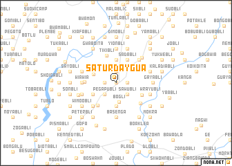
Saturdaygua (Grand Bassa, Liberia)Saturdaygua is a town in the Grand Bassa region of Liberia. An overview map of the region around Saturdaygua is displayed below.
regional and 3d topo map of Saturdaygua, Liberia ::
Saturdaygua airports ::
The nearest airport is ROB - Monrovia Roberts Intl, located 67.9 km west of Saturdaygua.
Other airports nearby include MLW - Monrovia Spriggs Payne (112.1 km west), Nearby towns ::
Sambli (0.0km north) //
Grablebli (1.8km west) //
Leebli (1.9km north) //
Josebli (1.8km east) //
Ganbli (1.9km north) //
Nyuno (2.6km south west) //
Pega Publi (2.6km south west) //
Sawubli (2.6km south east) //
Baunga (2.6km south west) //
Bogli (3.1km south) //
Johnnybli (2) (3.7km south) //
Guobli (3.7km south) //
Tumobli (3.7km north) //
Gougli (3.7km south) //
General Robertsbli (3.9km north east) //
Winibli (3.9km west) //
Sadabli (4.1km north east) //
Kledubli (4.1km south west) //
Golibli (4.1km south west) //
Weebo (4.6km south east) //
Wayon (4.7km south west) //
Tikibli (4.7km north) //
Sam Town (5.0km west) //
Jablebli (5.1km south east) //
Roberts (5.2km south west) //
Philip Robertsbli (5.2km north east) //
Yionbli (5.6km north) //
Basenga (5.6km south) //
Wia Wia (5.5km west) //
[all distances 'as the bird flies' and approximate]  Places with similar names to Saturdaygua, Liberia ::
// Saturdag (DE)
// Steiertag (HU)
// Sidéradougou (BF)
// (( Stredok )) (AL)
// Střídka (CZ)
// Stora Dicka (SE)
Disclaimer :: Information on this page comes without warranty of any kind |
||
|
Where is Saturdaygua? Elevation and coordinates ::
Latitude (lat): 6°12'0"N Longitude (lon): 9°45'0"W
Elevation (approx.): 161m (map arrows pan, magnifying glasses zoom) |
||
|
Visiting Saturdaygua? Hotel/Accommodation ::
Book a hotel in Saturdaygua Travel Guide ::
Buy a travel guide for Liberia rental cars ::
car rental offers GPS waypoint ::
download a GPX waypoint (PoI) of Saturdaygua for your GPS receiver
|
||