|
search place name
|
||
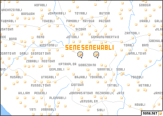
Senewabli (Grand Bassa, Liberia)Senewabli is a town in the Grand Bassa region of Liberia. An overview map of the region around Senewabli is displayed below.
regional and 3d topo map of Senewabli, Liberia ::
Senewabli airports ::
The nearest airport is ROB - Monrovia Roberts Intl, located 78.4 km north west of Senewabli.
Other airports nearby include MLW - Monrovia Spriggs Payne (120.1 km north west), Nearby towns ::
Dakui (2.6km north west) //
Gonyabli (2.6km north west) //
Dobozohn (3.1km south east) //
Dobozohn (1) (3.1km south east) //
Senewabli (3.7km east) //
Goniabli (3.8km north) //
Kptah Ploa (3.9km south west) //
Gongabli (4.1km south west) //
Jotobli (4.1km north west) //
Dobozohn (2) (4.1km south east) //
Bawebli (4.1km north east) //
Joe Johnnybli (4.4km west) //
Yeklebli (4.9km east) //
Baa (5.2km south east) //
Bajabli (5.6km south) //
Sizohn (5.6km north) //
Gomau (5.8km north east) //
Dubabli (5.9km north) //
Hon (5.8km west) //
Jobabli (5.8km east) //
Pobogle (5.9km north) //
Geplobli (6.7km south west) //
Sammybli (6.7km south east) //
Gomau Number Two (6.7km north east) //
Yokanbli (6.7km south east) //
Pomoble (6.7km north east) //
Dabebli (7.1km north east) //
Gio Town (7.4km south) //
Peter Graybli (7.4km west) //
[all distances 'as the bird flies' and approximate] 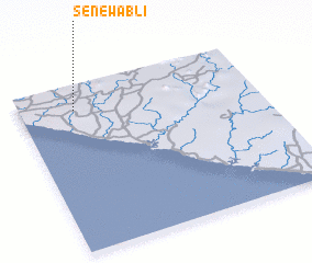 Places with similar names to Senewabli, Liberia ::
// Senewabli (LR)
Disclaimer :: Information on this page comes without warranty of any kind |
||
|
Where is Senewabli? Elevation and coordinates ::
Latitude (lat): 5°51'0"N Longitude (lon): 9°46'0"W
Elevation (approx.): 57m (map arrows pan, magnifying glasses zoom) |
||
|
Visiting Senewabli? Hotel/Accommodation ::
Book a hotel in Senewabli Travel Guide ::
Buy a travel guide for Liberia rental cars ::
car rental offers GPS waypoint ::
download a GPX waypoint (PoI) of Senewabli for your GPS receiver
|
||