|
search place name
|
||
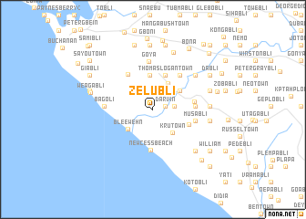
Zelubli (Grand Bassa, Liberia)Zelubli is a town in the Grand Bassa region of Liberia. An overview map of the region around Zelubli is displayed below.
regional and 3d topo map of Zelubli, Liberia ::
Zelubli airports ::
The nearest airport is ROB - Monrovia Roberts Intl, located 65.5 km north west of Zelubli.
Other airports nearby include MLW - Monrovia Spriggs Payne (104.2 km north west), Nearby towns ::
Darvin (1.5km east) //
Behn Town (2.6km east) //
Jacob Logan Town (3.7km north east) //
Krutown (3.8km south east) //
Bleewehn (3.9km south west) //
Logantown (4.0km north east) //
Gbankohn (4.0km north east) //
Flely (4.2km north) //
Layvin Town (4.2km north) //
Thomas Logan Town (4.4km north) //
Debablah (4.7km east) //
New Cess Beach (4.9km south) //
Boinsema (5.2km east) //
Behyn Town (5.2km east) //
Boyubli (5.3km north east) //
Feebli (5.3km north west) //
Musabli (5.3km east) //
Goya (5.9km north) //
Bagoli (5.9km west) //
Jababli (6.6km north east) //
Kaswabli (7.0km east) //
Gbalekua (7.1km east) //
Kla Klung (7.3km south east) //
Benbli (7.3km east) //
Barduah (7.4km north) //
New Cess (2) (7.9km north) //
Diatro (7.9km north) //
Blodu (7.9km north) //
Weagabli (7.9km west) //
[all distances 'as the bird flies' and approximate] 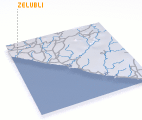 Places with similar names to Zelubli, Liberia ::
Disclaimer :: Information on this page comes without warranty of any kind |
||
|
Where is Zelubli? Elevation and coordinates ::
Latitude (lat): 5°48'46"N Longitude (lon): 9°56'47"W
Elevation (approx.): 27m (map arrows pan, magnifying glasses zoom) |
||
|
Visiting Zelubli? Hotel/Accommodation ::
Book a hotel in Zelubli Travel Guide ::
Buy a travel guide for Liberia rental cars ::
car rental offers GPS waypoint ::
download a GPX waypoint (PoI) of Zelubli for your GPS receiver
|
||