|
search place name
|
||
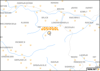
Josipdol (Cankova-Tišina, Slovenia)Josipdol is a town in the Cankova-Tišina region of Slovenia. An overview map of the region around Josipdol is displayed below.
regional and 3d topo map of Josipdol, Slovenia ::
Josipdol airports ::
The nearest airport is MBX - Maribor, located 31.2 km east of Josipdol.
Other airports nearby include GRZ - Graz (54.1 km north), LJU - Ljubliana Ljubljana (71.3 km south west), KLU - Klagenfurt (Worthersee Intl) (73.8 km west), ZAG - Zagreb (105.3 km south east), Nearby towns ::
Hudi Kot (1.2km west) //
Ribnica na Pohorju (2.2km north) //
Lehen na Pohorju (4.6km north east) //
Orlica (5.8km north) //
Janževski Vrh (6.0km north) //
Recenjak (5.5km east) //
Mala Mislinja (6.2km south west) //
Podvelka (8.7km north east) //
Brezno (9.3km north) //
Vuhred (9.4km north) //
[all distances 'as the bird flies' and approximate]  Places with similar names to Josipdol, Slovenia ::
// Josipdol (HR)
Disclaimer :: Information on this page comes without warranty of any kind |
||
|
Where is Josipdol? Elevation and coordinates ::
Latitude (lat): 46°30'58"N Longitude (lon): 15°16'57"E
Elevation (approx.): 845m (map arrows pan, magnifying glasses zoom) |
||
|
Visiting Josipdol? Hotel/Accommodation ::
Book a hotel in Josipdol Travel Guide ::
Buy a travel guide for Slovenia rental cars ::
car rental offers GPS waypoint ::
download a GPX waypoint (PoI) of Josipdol for your GPS receiver
|
||