|
search place name
|
||
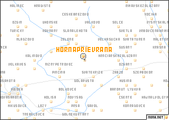
Horná Prievrana (Slovakia)Horná Prievrana is a town in Slovakia. An overview map of the region around Horná Prievrana is displayed below.
regional and 3d topo map of Horná Prievrana, Slovakia ::
Horná Prievrana airports ::
The nearest airport is SLD - Sliac, located 56.9 km north west of Horná Prievrana.
Other airports nearby include TAT - Poprad Tatry (81.2 km north), KSC - Kosice (109.2 km east), BUD - Budapest Ferihegy (115.0 km south), PZY - Piestany (149.0 km west), Nearby towns ::
Dolná Prievrana (0.0km north) //
Karol (1.9km north) //
Sväté Kríže (3.9km south) //
Poltár (3.9km north) //
Hanka (3.9km north) //
Zelené (4.4km north west) //
Dóla Pusta (5.6km south) //
Nižný Petrovec (4.1km south west) //
Slaná Lehota (5.7km north) //
Pinciná (5.2km south west) //
Veľké Dravce (6.1km south east) //
Pondelok (5.2km north east) //
Veľká Suchá (5.2km north east) //
Hrnčiarske Zalužany (4.9km east) //
Vaľkovo (7.5km north) //
Breznička (5.3km west) //
Zabzó (6.2km south east) //
Boľkovce (7.8km south) //
Rovňany (7.4km north west) //
Baromút (8.9km south east) //
Selce (8.9km north east) //
Uhorské (8.9km north west) //
[all distances 'as the bird flies' and approximate] 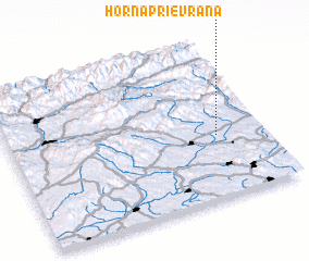 Places with similar names to Horná Prievrana, Slovakia :: Disclaimer :: Information on this page comes without warranty of any kind |
||
|
Where is Horná Prievrana? Elevation and coordinates ::
Latitude (lat): 48°24'0"N Longitude (lon): 19°49'0"E
Elevation (approx.): 236m (map arrows pan, magnifying glasses zoom) |
||
|
Visiting Horná Prievrana? Hotel/Accommodation ::
Book a hotel in Horná Prievrana Travel Guide ::
Buy a travel guide for Slovakia rental cars ::
car rental offers GPS waypoint ::
download a GPX waypoint (PoI) of Horná Prievrana for your GPS receiver
|
||