|
search place name
|
||
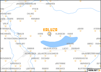
Kaluža (Slovakia)Kaluža is a town in Slovakia. An overview map of the region around Kaluža is displayed below.
regional and 3d topo map of Kaluža, Slovakia ::
Kaluža airports ::
The nearest airport is KSC - Kosice, located 58.4 km west of Kaluža.
Other airports nearby include TAT - Poprad Tatry (132.0 km west), SUJ - Satu Mare (140.2 km south east), RZE - Rzeszow Jasionka (143.8 km north), DEB - Debrecen (150.4 km south), Nearby towns ::
Vinné (2.4km west) //
Klokočov (2.4km east) //
Lazňany (5.6km south) //
Malé Zalužice (5.6km south) //
Trnava pri Laborci (4.9km west) //
Kusín (4.9km east) //
Veľké Zalužice (7.5km south) //
Hažín (7.5km south) //
Lúčky (6.7km south east) //
Porúbka (6.7km north west) //
Hnojné (6.1km south east) //
Zábava (7.4km south west) //
Straňany (7.4km south west) //
Chlmec (8.9km north west) //
Michalovce (8.9km south west) //
[all distances 'as the bird flies' and approximate] 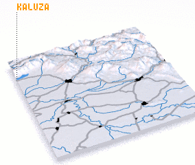 Places with similar names to Kaluža, Slovakia ::
Disclaimer :: Information on this page comes without warranty of any kind |
||
|
Where is Kaluža? Elevation and coordinates ::
Latitude (lat): 48°49'0"N Longitude (lon): 22°0'0"E
Elevation (approx.): 192m (map arrows pan, magnifying glasses zoom) |
||
|
Visiting Kaluža? Hotel/Accommodation ::
Book a hotel in Kaluža Travel Guide ::
Buy a travel guide for Slovakia rental cars ::
car rental offers GPS waypoint ::
download a GPX waypoint (PoI) of Kaluža for your GPS receiver
|
||