|
search place name
|
||
Kolbach (Slovakia)Kolbach is a town in Slovakia. An overview map of the region around Kolbach is displayed below.
regional and 3d topo map of Kolbach, Slovakia ::

Kolbach airports ::
The nearest airport is KSC - Kosice, located 45.4 km south east of Kolbach.
Other airports nearby include TAT - Poprad Tatry (51.0 km west), SLD - Sliac (138.7 km west), KRK - Krakow Balice (144.3 km north west), RZE - Rzeszow Jasionka (144.8 km north east), Nearby towns ::
Šindliar (2.2km north east) //
Široké (2.2km south east) //
Fričovce (2.4km east) //
Lipovce (3.9km north) //
Prameň Salvator (4.4km north east) //
Lačnov (5.6km north) //
Víťaz (5.7km south) //
Štefanovce (5.2km north east) //
Hendrichovce (4.9km east) //
Hrišovce (7.5km south) //
Ovčie (6.6km south east) //
Chminianske Jakubovany (6.1km south east) //
Vyšný Slavkov (7.4km north west) //
Vojkovce (8.9km south west) //
[all distances 'as the bird flies' and approximate] 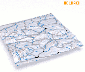 Places with similar names to Kolbach, Slovakia ::
Disclaimer :: Information on this page comes without warranty of any kind |
||
|
Where is Kolbach? Elevation and coordinates ::
Latitude (lat): 49°1'0"N Longitude (lon): 20°56'0"E
Elevation (approx.): 643m (map arrows pan, magnifying glasses zoom) |
||
|
Visiting Kolbach? Hotel/Accommodation ::
Book a hotel in Kolbach Travel Guide ::
Buy a travel guide for Slovakia rental cars ::
car rental offers GPS waypoint ::
download a GPX waypoint (PoI) of Kolbach for your GPS receiver
|
||