|
search place name
|
||
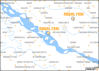
Nad Mlynmi (Slovakia)Nad Mlynmi is a town in Slovakia. An overview map of the region around Nad Mlynmi is displayed below.
regional and 3d topo map of Nad Mlynmi, Slovakia ::
Nad Mlynmi airports ::
The nearest airport is BTS - Bratislava M R Stefanik, located 41.4 km north west of Nad Mlynmi.
Other airports nearby include VIE - Vienna Schwechat (76.9 km west), PZY - Piestany (87.2 km north), BUD - Budapest Ferihegy (137.9 km east), SLD - Sliac (146.6 km north east), Nearby towns ::
Tejke (2.2km north east) //
Telke (2.2km north east) //
Malé Vranie (2.2km south east) //
Halomszél (3.7km north) //
Baka (3.7km north) //
Veľké Vranie (2.5km east) //
Ásványráró (4.5km south west) //
Vermes (5.6km north) //
Bokrospuszta (4.2km south west) //
Trstená na Ostrove (6.1km north west) //
Gabčíkovo (5.3km north east) //
Lipót (5.0km west) //
Jánosmajor (7.4km south) //
Jurová (7.5km north) //
Hédervár (6.2km south west) //
Zsejkepuszta (7.8km south) //
Bodíky (7.5km north west) //
Károlymajor (8.3km south west) //
Mecsér (8.3km south west) //
Rigótanya (8.3km south west) //
[all distances 'as the bird flies' and approximate] 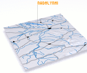 Places with similar names to Nad Mlynmi, Slovakia ::
// Nad Mlynmi (SK)
Disclaimer :: Information on this page comes without warranty of any kind |
||
|
Where is Nad Mlynmi? Elevation and coordinates ::
Latitude (lat): 47°52'0"N Longitude (lon): 17°32'0"E
Elevation (approx.): 124m (map arrows pan, magnifying glasses zoom) |
||
|
Visiting Nad Mlynmi? Hotel/Accommodation ::
Book a hotel in Nad Mlynmi Travel Guide ::
Buy a travel guide for Slovakia rental cars ::
car rental offers GPS waypoint ::
download a GPX waypoint (PoI) of Nad Mlynmi for your GPS receiver
|
||