|
search place name
|
||
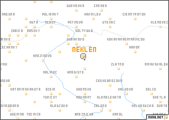
Neklen (Slovakia)Neklen is a town in Slovakia. An overview map of the region around Neklen is displayed below.
regional and 3d topo map of Neklen, Slovakia ::
Neklen airports ::
The nearest airport is SLD - Sliac, located 46.9 km west of Neklen.
Other airports nearby include TAT - Poprad Tatry (70.1 km north east), KSC - Kosice (110.9 km east), BUD - Budapest Ferihegy (127.4 km south), PZY - Piestany (142.1 km west), Nearby towns ::
Krná (1.9km south) //
Salajka (1.9km north) //
Chladná Studňa (2.2km north west) //
Hradište (3.9km south) //
Ďubákovo (3.9km north) //
Ipeľ (4.4km north west) //
Vlčovo (4.4km north west) //
Šoltýska (5.6km north) //
Dobrý Potok (4.1km north west) //
ľubenka (6.1km north west) //
Uhorské (7.4km south) //
Zlatno (5.2km east) //
Petrová (7.5km north) //
České Brezovo (6.7km south east) //
Málinec (6.2km south west) //
Bystrička (8.3km south west) //
Utekáč (8.3km north east) //
Ozdín (8.9km south west) //
Mláky (8.9km north west) //
[all distances 'as the bird flies' and approximate] 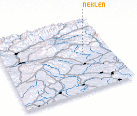 Places with similar names to Neklen, Slovakia ::
Disclaimer :: Information on this page comes without warranty of any kind |
||
|
Where is Neklen? Elevation and coordinates ::
Latitude (lat): 48°32'0"N Longitude (lon): 19°45'0"E
Elevation (approx.): 731m (map arrows pan, magnifying glasses zoom) |
||
|
Visiting Neklen? Hotel/Accommodation ::
Book a hotel in Neklen Travel Guide ::
Buy a travel guide for Slovakia rental cars ::
car rental offers GPS waypoint ::
download a GPX waypoint (PoI) of Neklen for your GPS receiver
|
||