|
search place name
|
||
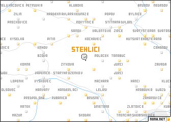
Stehlíci (Slovakia)Stehlíci is a town in Slovakia. An overview map of the region around Stehlíci is displayed below.
regional and 3d topo map of Stehlíci, Slovakia ::
Stehlíci airports ::
The nearest airport is PZY - Piestany, located 42.2 km south of Stehlíci.
Other airports nearby include PRV - Prerov (60.3 km north west), OSR - Ostrava Mosnov (78.7 km north), BRQ - Turany (90.9 km west), SLD - Sliac (98.1 km south east), Nearby towns ::
Vlčí Vrch (2.2km south east) //
Drha (2.4km east) //
Poláček (2.4km east) //
Kochavec (3.9km north) //
Žitková (3.1km south west) //
Starý Hrozenkov (4.4km south west) //
Šanov (5.7km north) //
Machara (6.1km south east) //
Valentové (6.1km north east) //
Dolná Závrská (5.2km south east) //
Hostětín (6.1km north west) //
Tarabuč (4.9km east) //
Režnáci (7.4km south) //
Rokytnice (7.4km north) //
Hulváci (7.4km south) //
Jurci (5.2km east) //
Horná Súča (6.1km south east) //
Jurci (6.1km south east) //
Lelaši (7.8km south) //
Pitín (6.1km north west) //
Handerláci (7.8km south) //
Žírce (7.4km north east) //
Jestřabí (8.3km north east) //
Štítná nad Vláří (8.9km north east) //
[all distances 'as the bird flies' and approximate] 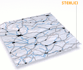 Places with similar names to Stehlíci, Slovakia ::
Disclaimer :: Information on this page comes without warranty of any kind |
||
|
Where is Stehlíci? Elevation and coordinates ::
Latitude (lat): 49°0'0"N Longitude (lon): 17°55'0"E
Elevation (approx.): 588m (map arrows pan, magnifying glasses zoom) |
||
|
Visiting Stehlíci? Hotel/Accommodation ::
Book a hotel in Stehlíci Travel Guide ::
Buy a travel guide for Slovakia rental cars ::
car rental offers GPS waypoint ::
download a GPX waypoint (PoI) of Stehlíci for your GPS receiver
|
||