|
search place name
|
||
Téske (Slovakia)Téske is a town in Slovakia. An overview map of the region around Téske is displayed below.
regional and 3d topo map of Téske, Slovakia ::

Téske airports ::
The nearest airport is TAT - Poprad Tatry, located 74.9 km north of Téske.
Other airports nearby include KSC - Kosice (81.1 km east), SLD - Sliac (84.2 km west), BUD - Budapest Ferihegy (128.9 km south west), DEB - Debrecen (145.5 km south east), Nearby towns ::
Nižná Kaloša (2.2km north east) //
Dulovo (2.2km south west) //
Figa (2.5km east) //
Gemerské Michalovce (3.7km north) //
Rokytník (2.5km west) //
Barca (3.9km south) //
Vyšná Kaloša (3.9km north) //
Žíp (3.9km south) //
Pusta Dapša (3.1km north east) //
Bátka (3.1km south west) //
Radnovce (5.6km south) //
Cakov (5.7km south) //
Vieska nad Blhom (5.7km south) //
Nižné Valice (5.7km north) //
Karkusz Pusta (5.2km north west) //
Gregorovce (6.1km north west) //
Stránska (4.9km east) //
Tomášovce (4.9km west) //
Vyšné Valice (7.5km north) //
Uzovská Panica (5.3km west) //
Žiar (6.2km north east) //
Ivanice (7.8km south) //
Rašice (7.8km north) //
Otročok (7.4km north east) //
Levkuška (8.3km north east) //
[all distances 'as the bird flies' and approximate] 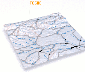 Places with similar names to Téske, Slovakia ::
Disclaimer :: Information on this page comes without warranty of any kind |
||
|
Where is Téske? Elevation and coordinates ::
Latitude (lat): 48°24'0"N Longitude (lon): 20°13'0"E
Elevation (approx.): 249m (map arrows pan, magnifying glasses zoom) |
||
|
Visiting Téske? Hotel/Accommodation ::
Book a hotel in Téske Travel Guide ::
Buy a travel guide for Slovakia rental cars ::
car rental offers GPS waypoint ::
download a GPX waypoint (PoI) of Téske for your GPS receiver
|
||