|
search place name
|
||
Kristiánov (Czech Republic)Kristiánov is a town in Czech Republic. An overview map of the region around Kristiánov is displayed below.
regional and 3d topo map of Kristiánov, Czech Republic ::

Kristiánov airports ::
The nearest airport is BBJ - Bautzen, located 62.7 km north west of Kristiánov.
Other airports nearby include PED - Pardubice (97.7 km south east), PRG - Prague Ruzyne (103.1 km south west), DRS - Dresden (105.5 km west), WRO - Wroclaw Strachowice (123.8 km east), Nearby towns ::
Hrabětice (3.7km south) //
Hraničná (4.4km south west) //
Janov nad Nisou (5.6km south) //
Bedřichov (4.3km south west) //
Ferdinandov (5.7km north) //
Lázně Libverda (6.4km north) //
Horní Maxov (6.0km south east) //
Bílý Potok (6.0km north east) //
Josefŭv Dŭl (5.8km south east) //
Jindřichov (7.4km south) //
Loučná (7.5km south) //
Dolní Maxov (6.6km south east) //
Hejnice (8.0km north) //
Rudolfov (6.0km south west) //
Nový Harcov (7.3km south west) //
Lukášov (8.2km south west) //
Antonínov (7.3km south east) //
Smržovka (9.6km south east) //
[all distances 'as the bird flies' and approximate] 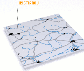 Places with similar names to Kristiánov, Czech Republic ::
// Kristiánov (CZ)
Disclaimer :: Information on this page comes without warranty of any kind |
||
|
Where is Kristiánov? Elevation and coordinates ::
Latitude (lat): 50°49'0"N Longitude (lon): 15°11'0"E
Elevation (approx.): 838m (map arrows pan, magnifying glasses zoom) |
||
|
Visiting Kristiánov? Hotel/Accommodation ::
Book a hotel in Kristiánov Travel Guide ::
rental cars ::
car rental offers GPS waypoint ::
download a GPX waypoint (PoI) of Kristiánov for your GPS receiver
|
||