|
search place name
|
||
Lhotsko (Czech Republic)Lhotsko is a town in Czech Republic. An overview map of the region around Lhotsko is displayed below.
regional and 3d topo map of Lhotsko, Czech Republic ::

Lhotsko airports ::
The nearest airport is PRV - Prerov, located 41.9 km north west of Lhotsko.
Other airports nearby include OSR - Ostrava Mosnov (55.8 km north), PZY - Piestany (65.9 km south), BRQ - Turany (87.0 km west), SLD - Sliac (112.0 km south east), Nearby towns ::
Lutonina (1.9km north) //
Ublo (2.2km north east) //
Vizovice (2.4km west) //
Na Nivě (3.7km south) //
Bratřejov (2.4km east) //
Chrastěšov (3.9km north) //
Jasenná (3.9km north) //
Újezd (5.7km south) //
Na Janové Hoře (4.1km south west) //
Dešná (6.1km north west) //
Vysoké Pole (5.2km south east) //
Raková (5.2km west) //
Všemina (7.5km north) //
Pozděchov (5.2km east) //
Neubuz (6.6km north west) //
Liptál (7.8km north) //
V Lúžku (7.8km north) //
Slopné (7.8km south) //
Homole (7.4km south west) //
Vlachova Lhota (8.9km south east) //
[all distances 'as the bird flies' and approximate] 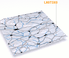 Places with similar names to Lhotsko, Czech Republic ::
// Lehotská (SK)
Disclaimer :: Information on this page comes without warranty of any kind |
||
|
Where is Lhotsko? Elevation and coordinates ::
Latitude (lat): 49°13'0"N Longitude (lon): 17°53'0"E
Elevation (approx.): 367m (map arrows pan, magnifying glasses zoom) |
||
|
Visiting Lhotsko? Hotel/Accommodation ::
Book a hotel in Lhotsko Travel Guide ::
rental cars ::
car rental offers GPS waypoint ::
download a GPX waypoint (PoI) of Lhotsko for your GPS receiver
|
||