|
search place name
|
||
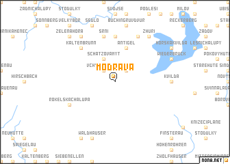
Modrava (Czech Republic)Modrava is a town in Czech Republic. An overview map of the region around Modrava is displayed below.
regional and 3d topo map of Modrava, Czech Republic ::
Modrava airports ::
The nearest airport is LNZ - Linz (Horsching), located 100.8 km south east of Modrava.
Other airports nearby include PRG - Prague Ruzyne (132.5 km north east), KLV - Karlovy Vary (138.6 km north), SZG - Salzburg (140.9 km south), MUC - Munich Munchen (146.1 km south west), Nearby towns ::
Filipova Huť (2.2km north east) //
Vchynice-Tetov (2.2km north west) //
Schätzova Mytʼ (3.9km north) //
Antigel (5.7km north) //
Hrádky (7.4km north) //
Srní (7.5km north) //
Kaltenbrunn (6.6km north west) //
Nový Dŭm (7.8km north) //
Rokelská Chalupa (6.1km south west) //
Horky (8.3km north west) //
Zhŭří (8.3km north east) //
Nová Studnice (8.9km north west) //
Zelená Hora (8.9km north west) //
[all distances 'as the bird flies' and approximate] 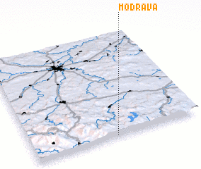 Places with similar names to Modrava, Czech Republic ::
Disclaimer :: Information on this page comes without warranty of any kind |
||
|
Where is Modrava? Elevation and coordinates ::
Latitude (lat): 49°1'0"N Longitude (lon): 13°30'0"E
Elevation (approx.): 1068m (map arrows pan, magnifying glasses zoom) |
||
|
Visiting Modrava? Hotel/Accommodation ::
Book a hotel in Modrava Travel Guide ::
rental cars ::
car rental offers GPS waypoint ::
download a GPX waypoint (PoI) of Modrava for your GPS receiver
|
||