|
search place name
|
||
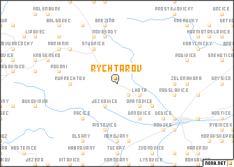
Rychtářov (Czech Republic)Rychtářov is a town in Czech Republic. An overview map of the region around Rychtářov is displayed below.
regional and 3d topo map of Rychtářov, Czech Republic ::
Rychtářov airports ::
The nearest airport is BRQ - Turany, located 25.9 km south west of Rychtářov.
Other airports nearby include PRV - Prerov (36.9 km east), OSR - Ostrava Mosnov (95.4 km north east), PZY - Piestany (103.2 km south east), PED - Pardubice (113.8 km north west), Nearby towns ::
Pařezovice (2.2km south east) //
Lhota (3.0km south east) //
Ježkovice (3.9km south) //
Opatovice (4.4km south east) //
Drnovice (6.1km south east) //
Hamiltony (5.2km south east) //
Studnice (6.1km north west) //
Ruprechtov (4.8km west) //
Pístovice (7.5km south) //
Nové Sady (7.5km north) //
Račice (6.6km south west) //
Odrŭvky (7.8km north) //
Pazderna (7.4km south east) //
Dědice (7.4km south east) //
Kulířov (7.4km north west) //
Nouzka (8.9km south east) //
Nosálovice (8.9km south east) //
[all distances 'as the bird flies' and approximate] 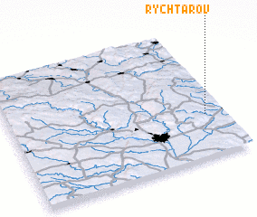 Places with similar names to Rychtářov, Czech Republic ::
// Rychtárová (SK)
// Rychtářov (CZ)
Disclaimer :: Information on this page comes without warranty of any kind |
||
|
Where is Rychtářov? Elevation and coordinates ::
Latitude (lat): 49°20'0"N Longitude (lon): 16°55'0"E
Elevation (approx.): 401m (map arrows pan, magnifying glasses zoom) |
||
|
Visiting Rychtářov? Hotel/Accommodation ::
Book a hotel in Rychtářov Travel Guide ::
rental cars ::
car rental offers GPS waypoint ::
download a GPX waypoint (PoI) of Rychtářov for your GPS receiver
|
||