|
search place name
|
||
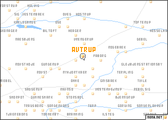
Avtrup (Ribe, Denmark)Avtrup is a town in the Ribe region of Denmark. An overview map of the region around Avtrup is displayed below.
regional and 3d topo map of Avtrup, Denmark ::
Avtrup airports ::
The nearest airport is EBJ - Esbjerg, located 12.1 km south west of Avtrup.
Other airports nearby include BLL - Billund (32.5 km north east), STA - Stauning (50.7 km north west), SKS - Skrydstrup (52.8 km south east), GWT - Westerland Sylt (78.3 km south), Nearby towns ::
Tranbjerg (1.0km west) //
Over Slebsager (2.1km south east) //
Fåborg (2.1km east) //
Vrenderup (3.7km north) //
Fuglsig (3.9km south) //
Jyllerup (3.9km south) //
Ny Hjortkær (3.9km south) //
Hjortkær (5.6km south) //
Årre (3.6km south west) //
Heager (5.7km north) //
Omme (5.7km south) //
Endrup (7.5km south) //
Rodebæk (4.6km north east) //
Gunderup (4.6km south west) //
Grisbæk (6.4km south east) //
Ravnsø (7.7km south) //
Nordenskov (7.7km north) //
Grimstrup (8.1km south west) //
Vester Vejrup (8.1km south east) //
Biltoft (7.0km north west) //
Øse (8.1km north west) //
Nørre Vejrup (8.5km south east) //
Bækmark (8.5km south east) //
[all distances 'as the bird flies' and approximate] 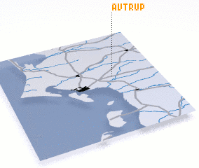 Places with similar names to Avtrup, Denmark :: Disclaimer :: Information on this page comes without warranty of any kind |
||
|
Where is Avtrup? Elevation and coordinates ::
Latitude (lat): 55°35'0"N Longitude (lon): 8°43'0"E
Elevation (approx.): 27m (map arrows pan, magnifying glasses zoom) |
||
|
Visiting Avtrup? Hotel/Accommodation ::
Book a hotel in Avtrup Travel Guide ::
Buy a travel guide for Denmark rental cars ::
car rental offers GPS waypoint ::
download a GPX waypoint (PoI) of Avtrup for your GPS receiver
|
||