|
search place name
|
||
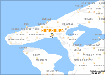
Hanehoved (Frederiksborg, Denmark)Hanehoved is a town in the Frederiksborg region of Denmark. An overview map of the region around Hanehoved is displayed below.
regional and 3d topo map of Hanehoved, Denmark ::
Hanehoved airports ::
The nearest airport is RKE - Copenhagen Roskilde, located 43.2 km south of Hanehoved.
Other airports nearby include JLD - Landskrona (54.4 km east), CPH - Copenhagen Kastrup (56.6 km south east), AAR - Aarhus (93.5 km north west), HAD - Halmstad (95.3 km north east), Nearby towns ::
Evetofte (2.1km north west) //
Åsebro Huse (2.1km north east) //
Arresødal (2.1km east) //
Frederiksværk (2.1km east) //
Vinderød (2.8km north east) //
Hågendrup (2.8km north west) //
Melby (3.8km north) //
Tollerup (4.2km north west) //
Sverkilstrup (3.1km west) //
Brederød (3.1km east) //
Torup (3.6km north west) //
Asserbo (5.7km north) //
Liseleje (5.7km north) //
Karsemose (4.8km north east) //
Sonnerup (4.1km east) //
Avderød (4.1km east) //
Kregme (4.5km south east) //
Skoven (8.0km south west) //
[all distances 'as the bird flies' and approximate] 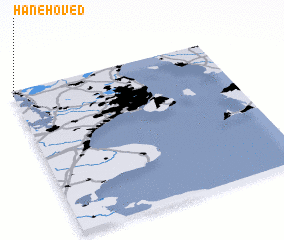 Places with similar names to Hanehoved, Denmark :: Disclaimer :: Information on this page comes without warranty of any kind |
||
|
Where is Hanehoved? Elevation and coordinates ::
Latitude (lat): 55°58'0"N Longitude (lon): 12°0'0"E
Elevation (approx.): -32768m (map arrows pan, magnifying glasses zoom) |
||
|
Visiting Hanehoved? Hotel/Accommodation ::
Book a hotel in Hanehoved Travel Guide ::
Buy a travel guide for Denmark rental cars ::
car rental offers GPS waypoint ::
download a GPX waypoint (PoI) of Hanehoved for your GPS receiver
|
||