|
search place name
|
||
Holmen (Nordjylland, Denmark)Holmen is a town in the Nordjylland region of Denmark. An overview map of the region around Holmen is displayed below.
regional and 3d topo map of Holmen, Denmark ::

Holmen airports ::
The nearest airport is AAL - Aalborg, located 32.8 km south of Holmen.
Other airports nearby include TED - Thisted (82.0 km south west), GSE - Gothenborg Save (123.8 km east), AAR - Aarhus (127.7 km south), KRP - Karup (130.6 km south west), Nearby towns ::
Rakkeby (1.9km north) //
Smidstrup (2.1km north west) //
Gunderup (2.0km east) //
Em (3.8km south) //
Vrå (3.8km south) //
Sønder Vrå (3.8km south) //
Borup (2.7km south east) //
Vollerup (4.2km south west) //
Foldbjerg (4.2km south east) //
Vejby (3.0km west) //
Harken (3.0km east) //
Sønder Harritslev (5.6km north) //
Refsnæs (5.6km south) //
Grønnerup (4.8km south east) //
Hæstrup (4.8km north east) //
Linderup (7.5km south) //
Sankt Knuds By (7.5km north) //
Årup (6.3km south east) //
Bagterp (6.3km north east) //
Nørre Harritslev (7.7km north) //
Vansted Mark (7.7km north) //
Tømmerby (8.0km south) //
Stenum (8.0km south) //
Serritslev (8.0km south) //
Kalum (8.0km south) //
Låge (8.4km north west) //
[all distances 'as the bird flies' and approximate] 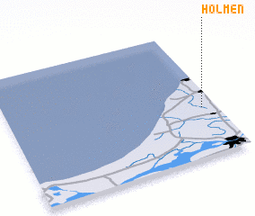 Places with similar names to Holmen, Denmark ::
Disclaimer :: Information on this page comes without warranty of any kind |
||
|
Where is Holmen? Elevation and coordinates ::
Latitude (lat): 57°23'0"N Longitude (lon): 9°56'0"E
Elevation (approx.): 12m (map arrows pan, magnifying glasses zoom) |
||
|
Visiting Holmen? Hotel/Accommodation ::
Book a hotel in Holmen Travel Guide ::
Buy a travel guide for Denmark rental cars ::
car rental offers GPS waypoint ::
download a GPX waypoint (PoI) of Holmen for your GPS receiver
|
||