|
search place name
|
||
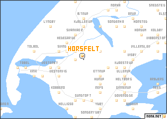
Horsfelt (Viborg, Denmark)Horsfelt is a town in the Viborg region of Denmark. An overview map of the region around Horsfelt is displayed below.
regional and 3d topo map of Horsfelt, Denmark ::
Horsfelt airports ::
The nearest airport is TED - Thisted, located 35.8 km north east of Horsfelt.
Other airports nearby include KRP - Karup (72.2 km south east), STA - Stauning (90.2 km south), AAL - Aalborg (95.0 km east), BLL - Billund (127.2 km south), Nearby towns ::
Villerup (1.0km west) //
Morup Mølle (2.1km north west) //
Svindborg (2.7km north west) //
Bedsted (2.7km north east) //
Hedegårde (4.2km north west) //
Ettrup (4.2km south east) //
Svankær (5.7km north) //
Grurup (3.6km south east) //
Tygstrup (3.6km south west) //
Ørum (3.6km north west) //
Vestervig (4.8km south west) //
Hurup (5.9km south) //
Kjallerup (7.4km north) //
Vesterby (4.5km south west) //
Gammelby (4.5km south east) //
Refs (7.7km south) //
Madsted (7.7km north) //
Kobberø (8.0km south) //
Lyngby (8.5km north west) //
Sønderhå (8.5km north east) //
[all distances 'as the bird flies' and approximate] 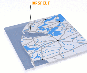 Places with similar names to Horsfelt, Denmark ::
// Harsefeld (DE)
// Herzfeld (DE)
// Herzfeld (DE)
// Herzfelde (DE)
// Herzfelde (DE)
// Herzfelde (DE)
// Haresfield (GB)
// Herzfeld (DE)
// Harrisfield (AU)
Disclaimer :: Information on this page comes without warranty of any kind |
||
|
Where is Horsfelt? Elevation and coordinates ::
Latitude (lat): 56°48'0"N Longitude (lon): 8°23'0"E
Elevation (approx.): 21m (map arrows pan, magnifying glasses zoom) |
||
|
Visiting Horsfelt? Hotel/Accommodation ::
Book a hotel in Horsfelt Travel Guide ::
Buy a travel guide for Denmark rental cars ::
car rental offers GPS waypoint ::
download a GPX waypoint (PoI) of Horsfelt for your GPS receiver
|
||