|
search place name
|
||
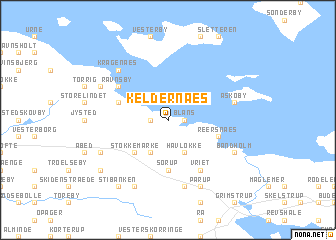
Keldernæs (Storstrøm, Denmark)Keldernæs is a town in the Storstrøm region of Denmark. An overview map of the region around Keldernæs is displayed below.
regional and 3d topo map of Keldernæs, Denmark ::
Keldernæs airports ::
The nearest airport is RKE - Copenhagen Roskilde, located 92.1 km north east of Keldernæs.
Other airports nearby include ODE - Odense (96.9 km north west), KEL - Kiel Holtenau (98.4 km south west), SGD - Soenderborg Sonderborg (104.8 km west), CPH - Copenhagen Kastrup (114.9 km north east), Nearby towns ::
Blans (1.1km east) //
Saltvig (1.1km west) //
Havløkke (3.9km south) //
Keldernæsskov (3.9km south) //
Stokkemarke (4.3km south west) //
Sørup (5.6km south) //
Hejringe (3.7km north west) //
Reersnæs (3.7km south east) //
Ravnsby (4.9km north west) //
Vriet (6.0km south) //
Askø By (4.7km north east) //
Østofte (7.5km south) //
Nørreballe (7.5km south) //
Kragenæs (6.4km north west) //
Bandholm (5.7km south east) //
Birket (5.7km north west) //
Pårup (7.7km south) //
Brandsmose (5.7km south west) //
Langet (7.7km south) //
Tjennemarke (7.0km south west) //
Stibanken (8.1km south west) //
[all distances 'as the bird flies' and approximate] 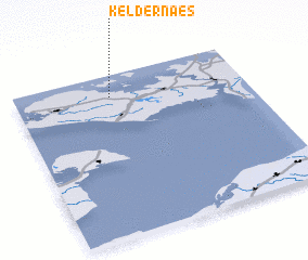 Places with similar names to Keldernæs, Denmark ::
Disclaimer :: Information on this page comes without warranty of any kind |
||
|
Where is Keldernæs? Elevation and coordinates ::
Latitude (lat): 54°52'0"N Longitude (lon): 11°25'0"E
Elevation (approx.): -3m (map arrows pan, magnifying glasses zoom) |
||
|
Visiting Keldernæs? Hotel/Accommodation ::
Book a hotel in Keldernæs Travel Guide ::
Buy a travel guide for Denmark rental cars ::
car rental offers GPS waypoint ::
download a GPX waypoint (PoI) of Keldernæs for your GPS receiver
|
||