|
search place name
|
||
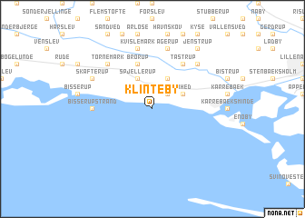
Klinteby (Storstrøm, Denmark)Klinteby is a town in the Storstrøm region of Denmark. An overview map of the region around Klinteby is displayed below.
regional and 3d topo map of Klinteby, Denmark ::
Klinteby airports ::
The nearest airport is RKE - Copenhagen Roskilde, located 56.7 km north east of Klinteby.
Other airports nearby include CPH - Copenhagen Kastrup (83.4 km north east), ODE - Odense (85.9 km north west), SGD - Soenderborg Sonderborg (117.0 km west), JLD - Landskrona (117.3 km north east), Nearby towns ::
Klinteby Frihed (2.1km north east) //
Spjellerup (3.9km north) //
Menstrup (3.9km north) //
Karrebækstorp (2.8km north east) //
Brorup (5.7km north) //
Tåstrup (5.9km north) //
Bisserup Strand (4.2km west) //
Kvislemark (7.5km north) //
Agerup (7.5km north) //
Tornemark (6.4km north west) //
Saltø By (6.4km north east) //
Skafterup (5.6km north west) //
Jenstrup (8.1km north east) //
[all distances 'as the bird flies' and approximate]  Places with similar names to Klinteby, Denmark ::
// Kolonia Dębe (PL)
// Kelintöbe (KZ)
// Kolendouba (GN)
// Kolondiéba (ML)
// Klinteby (DK)
// Klintbo (SE)
Disclaimer :: Information on this page comes without warranty of any kind |
||
|
Where is Klinteby? Elevation and coordinates ::
Latitude (lat): 55°11'0"N Longitude (lon): 11°35'0"E
Elevation (approx.): -32768m (map arrows pan, magnifying glasses zoom) |
||
|
Visiting Klinteby? Hotel/Accommodation ::
Book a hotel in Klinteby Travel Guide ::
Buy a travel guide for Denmark rental cars ::
car rental offers GPS waypoint ::
download a GPX waypoint (PoI) of Klinteby for your GPS receiver
|
||