|
search place name
|
||
Klotrup (Viborg, Denmark)Klotrup is a town in the Viborg region of Denmark. An overview map of the region around Klotrup is displayed below.
regional and 3d topo map of Klotrup, Denmark ::

Klotrup airports ::
The nearest airport is KRP - Karup, located 47.0 km south west of Klotrup.
Other airports nearby include AAL - Aalborg (52.2 km north east), TED - Thisted (61.8 km north west), AAR - Aarhus (84.6 km south east), STA - Stauning (102.1 km south west), Nearby towns ::
Knudstrup (2.1km north west) //
Fjelsø (2.1km south east) //
Bygum (2.1km north east) //
Øster Bølle (2.1km north east) //
Ettrup (3.8km south) //
Lille Torup (4.2km south west) //
Gammel Hvam (3.6km south east) //
Glerup (3.6km north west) //
Troelstrup (4.8km south east) //
Firhøje (4.1km west) //
Vognsild (7.4km north) //
Bystrup (4.5km south west) //
Hvam (4.5km south east) //
Vestrup (7.5km north) //
Ålestrup (4.5km north east) //
Store Torup (5.5km south west) //
Gjørup (5.5km south west) //
Vester Bølle (5.5km north west) //
Vester Tostrup (7.7km south) //
Guldager (5.5km north east) //
Testrup (5.5km north east) //
Østrup (8.0km north) //
Møldrup (8.5km south east) //
[all distances 'as the bird flies' and approximate] 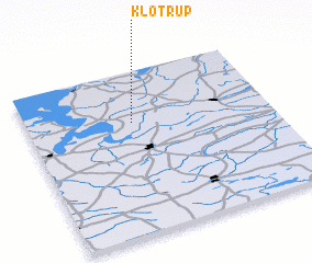 Places with similar names to Klotrup, Denmark ::
Disclaimer :: Information on this page comes without warranty of any kind |
||
|
Where is Klotrup? Elevation and coordinates ::
Latitude (lat): 56°41'0"N Longitude (lon): 9°26'0"E
Elevation (approx.): 32m (map arrows pan, magnifying glasses zoom) |
||
|
Visiting Klotrup? Hotel/Accommodation ::
Book a hotel in Klotrup Travel Guide ::
Buy a travel guide for Denmark rental cars ::
car rental offers GPS waypoint ::
download a GPX waypoint (PoI) of Klotrup for your GPS receiver
|
||