|
search place name
|
||
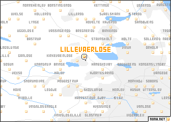
Lille Værløse (København, Denmark)Lille Værløse is a town in the København region of Denmark. An overview map of the region around Lille Værløse is displayed below.
regional and 3d topo map of Lille Værløse, Denmark ::
Lille Værløse airports ::
The nearest airport is CPH - Copenhagen Kastrup, located 25.2 km south east of Lille Værløse.
Other airports nearby include RKE - Copenhagen Roskilde (27.1 km south west), JLD - Landskrona (35.3 km north east), MMX - Malmoe Sturup (68.3 km south east), HAD - Halmstad (104.6 km north), Nearby towns ::
Søndergården (1.0km west) //
Farum (2.1km north west) //
Hareskovby (2.8km south east) //
Hjortespring (4.3km south east) //
Stavnsholt (4.3km north east) //
Bregnerød (5.6km north) //
Kirke-Værløse (3.1km west) //
Bringe (3.6km south west) //
Ballerup (5.7km south) //
Værløse (6.5km south) //
Uggeløse (5.9km north) //
Måløv (4.8km south west) //
Pederstrup (5.9km south) //
Bistrup (4.8km north east) //
Skovlunde (7.5km south) //
Høvelte (7.5km north) //
Birkerød (6.4km north east) //
Vassingerød (6.4km north west) //
Ågerup (8.0km south west) //
Kajerød (8.0km north east) //
Ledøje (8.5km south west) //
Herlev (8.5km south east) //
[all distances 'as the bird flies' and approximate] 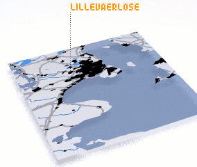 Places with similar names to Lille Værløse, Denmark :: Disclaimer :: Information on this page comes without warranty of any kind |
||
|
Where is Lille Værløse? Elevation and coordinates ::
Latitude (lat): 55°47'0"N Longitude (lon): 12°23'0"E
Elevation (approx.): 53m (map arrows pan, magnifying glasses zoom) |
||
|
Visiting Lille Værløse? Hotel/Accommodation ::
Book a hotel in Lille Værløse Travel Guide ::
Buy a travel guide for Denmark rental cars ::
car rental offers GPS waypoint ::
download a GPX waypoint (PoI) of Lille Værløse for your GPS receiver
|
||