|
search place name
|
||
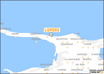
Lumsås (Vestsjælland, Denmark)Lumsås is a town in the Vestsjælland region of Denmark. An overview map of the region around Lumsås is displayed below.
regional and 3d topo map of Lumsås, Denmark ::
Lumsås airports ::
The nearest airport is RKE - Copenhagen Roskilde, located 56.0 km south east of Lumsås.
Other airports nearby include AAR - Aarhus (68.1 km north west), CPH - Copenhagen Kastrup (80.5 km south east), JLD - Landskrona (84.5 km east), ODE - Odense (91.3 km south west), Nearby towns ::
Ebbeløkke (1.0km west) //
Holmstrup (2.8km south east) //
Tjørneholm (3.1km west) //
Veddinge (3.6km south west) //
Sonnerup (3.6km south east) //
Stenstrup (3.6km south east) //
Gudmindrup (4.8km south east) //
[all distances 'as the bird flies' and approximate] 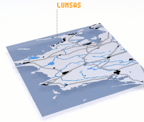 Places with similar names to Lumsås, Denmark ::
// Lemiesze (PL)
// Lemieszów (PL)
// Loomises (US)
// Lamséssé (BJ)
// Lammzoussi (BF)
// Lammzoussi (BF)
// Lemosusu (ID)
// Lomsis (PG)
// Le Mazis (FR)
// Limousis (FR)
Disclaimer :: Information on this page comes without warranty of any kind |
||
|
Where is Lumsås? Elevation and coordinates ::
Latitude (lat): 55°57'0"N Longitude (lon): 11°31'0"E
Elevation (approx.): 8m (map arrows pan, magnifying glasses zoom) |
||
|
Visiting Lumsås? Hotel/Accommodation ::
Book a hotel in Lumsås Travel Guide ::
Buy a travel guide for Denmark rental cars ::
car rental offers GPS waypoint ::
download a GPX waypoint (PoI) of Lumsås for your GPS receiver
|
||