|
search place name
|
||
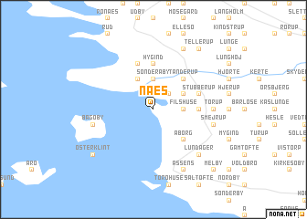
Næs (Fyn, Denmark)Næs is a town in the Fyn region of Denmark. An overview map of the region around Næs is displayed below.
regional and 3d topo map of Næs, Denmark ::
Næs airports ::
The nearest airport is ODE - Odense, located 32.5 km north east of Næs.
Other airports nearby include SKS - Skrydstrup (41.2 km west), SGD - Soenderborg Sonderborg (41.5 km south), BLL - Billund (64.7 km north west), EBJ - Esbjerg (86.9 km west), Nearby towns ::
Emtekær (2.1km north east) //
Filshuse (2.1km east) //
Sønder Åby (3.7km north) //
Husby (3.9km north) //
Nakke (2.8km north east) //
Aborg (4.3km south east) //
Tanderup (4.3km north east) //
Håre (4.3km north east) //
Hygind (5.6km north) //
Sandager (3.2km east) //
Eskør (5.7km north) //
Stubberup (3.7km north east) //
Torup (4.2km east) //
Bågø By (4.6km south west) //
Smejrup (4.6km south east) //
Lundager (6.4km south east) //
Grimstrup (6.4km south east) //
Assens (7.7km south) //
Ørslev (7.7km north) //
Østerklint (7.0km south west) //
Tellerup (8.1km north east) //
Melby (8.5km south east) //
[all distances 'as the bird flies' and approximate]  Places with similar names to Næs, Denmark ::
Disclaimer :: Information on this page comes without warranty of any kind |
||
|
Where is Næs? Elevation and coordinates ::
Latitude (lat): 55°20'0"N Longitude (lon): 9°53'0"E
Elevation (approx.): 5m (map arrows pan, magnifying glasses zoom) |
||
|
Visiting Næs? Hotel/Accommodation ::
Book a hotel in Næs Travel Guide ::
Buy a travel guide for Denmark rental cars ::
car rental offers GPS waypoint ::
download a GPX waypoint (PoI) of Næs for your GPS receiver
|
||