|
search place name
|
||
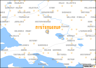
Ny Stenderup (Fyn, Denmark)Ny Stenderup is a town in the Fyn region of Denmark. An overview map of the region around Ny Stenderup is displayed below.
regional and 3d topo map of Ny Stenderup, Denmark ::
Ny Stenderup airports ::
The nearest airport is ODE - Odense, located 34.8 km north of Ny Stenderup.
Other airports nearby include SGD - Soenderborg Sonderborg (37.8 km south west), SKS - Skrydstrup (64.2 km west), KEL - Kiel Holtenau (88.0 km south), BLL - Billund (95.2 km north west), Nearby towns ::
Gammel Stenderup (1.9km north) //
Vester Hæsinge (3.9km north) //
Tørringe (5.6km north) //
Øster Hæsinge (3.7km north east) //
Svanninge (5.7km south) //
Gerup (3.7km south east) //
Sandholts-Lyndelse (4.9km north east) //
Millinge (4.9km south west) //
Østerby (4.9km south west) //
Sønder Broby (7.4km north) //
Kaleko (7.4km south) //
Håstrup (4.2km west) //
Radby (4.2km west) //
Brobyværk (7.5km north) //
Fleninge (4.6km south east) //
Fåborg (7.5km south) //
Allerup (7.7km north) //
Diernæs (7.7km south) //
Skovhuse (8.5km north east) //
Bjerne (8.5km south west) //
[all distances 'as the bird flies' and approximate] 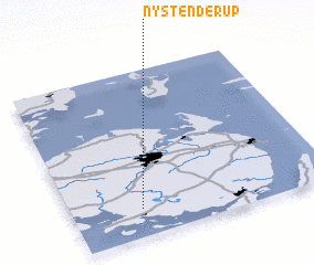 Places with similar names to Ny Stenderup, Denmark :: Disclaimer :: Information on this page comes without warranty of any kind |
||
|
Where is Ny Stenderup? Elevation and coordinates ::
Latitude (lat): 55°10'0"N Longitude (lon): 10°16'0"E
Elevation (approx.): 72m (map arrows pan, magnifying glasses zoom) |
||
|
Visiting Ny Stenderup? Hotel/Accommodation ::
Book a hotel in Ny Stenderup Travel Guide ::
Buy a travel guide for Denmark rental cars ::
car rental offers GPS waypoint ::
download a GPX waypoint (PoI) of Ny Stenderup for your GPS receiver
|
||