|
search place name
|
||
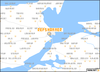
Refshammer (Viborg, Denmark)Refshammer is a town in the Viborg region of Denmark. An overview map of the region around Refshammer is displayed below.
regional and 3d topo map of Refshammer, Denmark ::
Refshammer airports ::
The nearest airport is TED - Thisted, located 33.3 km north of Refshammer.
Other airports nearby include KRP - Karup (56.4 km south), AAL - Aalborg (69.0 km north east), STA - Stauning (93.8 km south), BLL - Billund (117.5 km south), Nearby towns ::
Glyngøre (1.9km south) //
Nykøbing Mors (1.9km north) //
Fårup (2.1km south west) //
Vodstrup (2.7km north west) //
Sallingsund (5.6km south) //
Legind (3.6km south west) //
Sæby (3.6km south east) //
Nautrup (4.8km south east) //
Bysted (4.8km south east) //
Bjørndrup (5.9km north) //
Grynderup (4.1km east) //
Vile (7.4km south) //
Lødderup (4.1km west) //
Elsø (4.5km north west) //
Tødsø (6.3km north west) //
Glynge (5.5km south east) //
Kårup (5.5km south west) //
Alsted (7.7km north) //
Dalstrup (8.0km south) //
Harre (8.5km south east) //
[all distances 'as the bird flies' and approximate] 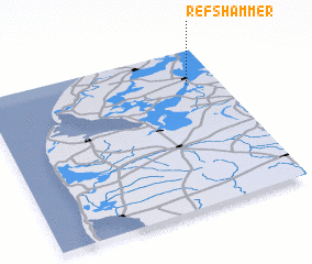 Places with similar names to Refshammer, Denmark :: Disclaimer :: Information on this page comes without warranty of any kind |
||
|
Where is Refshammer? Elevation and coordinates ::
Latitude (lat): 56°47'0"N Longitude (lon): 8°52'0"E
Elevation (approx.): -32768m (map arrows pan, magnifying glasses zoom) |
||
|
Visiting Refshammer? Hotel/Accommodation ::
Book a hotel in Refshammer Travel Guide ::
Buy a travel guide for Denmark rental cars ::
car rental offers GPS waypoint ::
download a GPX waypoint (PoI) of Refshammer for your GPS receiver
|
||