|
search place name
|
||
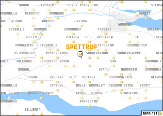
Spettrup (Vejle, Denmark)Spettrup is a town in the Vejle region of Denmark. An overview map of the region around Spettrup is displayed below.
regional and 3d topo map of Spettrup, Denmark ::
Spettrup airports ::
The nearest airport is BLL - Billund, located 38.9 km west of Spettrup.
Other airports nearby include ODE - Odense (49.3 km south east), SKS - Skrydstrup (69.8 km south west), KRP - Karup (69.8 km north west), AAR - Aarhus (78.3 km north east), Nearby towns ::
Nørre Aldum (1.0km east) //
Ølsted Nederholm (1.9km north) //
Urlev (2.1km south east) //
Ølsted Overholm (2.1km north east) //
Store Dalby (2.1km south west) //
Sønder Aldum (2.1km east) //
Lystrup (2.8km north east) //
Oens (3.9km north) //
Lille Dalby (2.8km south west) //
Torup (2.8km south west) //
Bottrup (3.9km north) //
Remmerslund (3.1km west) //
Hostrup (5.7km south) //
Eriknauer (5.7km north) //
Stenderup (3.6km north east) //
Sebberup (3.6km north west) //
Ørum (5.7km south) //
Hornum (4.8km south east) //
Ørnstrup (4.8km north east) //
Nørre Bjerre (4.2km east) //
Belle (7.4km south) //
Hatting (7.4km north) //
Brå (4.6km south east) //
Hedensted (4.6km south west) //
Løsning (4.6km north west) //
Stubberup (4.6km north west) //
Torsted (6.4km north east) //
Daugård (6.4km south west) //
Gammelby (7.7km south) //
[all distances 'as the bird flies' and approximate] 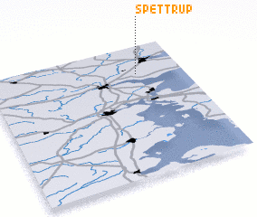 Places with similar names to Spettrup, Denmark ::
// Spøttrup (DK)
Disclaimer :: Information on this page comes without warranty of any kind |
||
|
Where is Spettrup? Elevation and coordinates ::
Latitude (lat): 55°47'0"N Longitude (lon): 9°46'0"E
Elevation (approx.): 57m (map arrows pan, magnifying glasses zoom) |
||
|
Visiting Spettrup? Hotel/Accommodation ::
Book a hotel in Spettrup Travel Guide ::
Buy a travel guide for Denmark rental cars ::
car rental offers GPS waypoint ::
download a GPX waypoint (PoI) of Spettrup for your GPS receiver
|
||