|
search place name
|
||
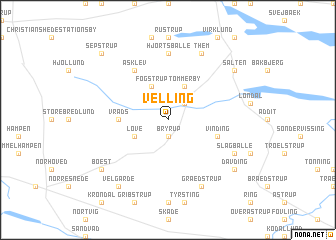
Velling (Århus, Denmark)Velling is a town in the Århus region of Denmark. An overview map of the region around Velling is displayed below.
regional and 3d topo map of Velling, Denmark ::
Velling airports ::
The nearest airport is KRP - Karup, located 38.2 km north west of Velling.
Other airports nearby include BLL - Billund (39.8 km south west), STA - Stauning (72.7 km west), AAR - Aarhus (74.6 km north east), ODE - Odense (80.3 km south east), Nearby towns ::
Bryrup (1.9km south) //
Katrinedal Mark (2.1km north east) //
Tømmerby (3.8km north) //
Løve (2.8km south west) //
Fogstrup (3.8km north) //
Vrads (3.1km west) //
Vinding (3.6km south east) //
Asklev (5.9km north) //
Hjortsballe (7.4km north) //
Slagballe (5.6km south east) //
Grædstrup (7.7km south) //
Them (7.7km north) //
Salten (6.9km north east) //
Davding (6.9km south east) //
Velgårde (8.0km south west) //
Boest (6.9km south west) //
Sepstrup (8.5km north west) //
[all distances 'as the bird flies' and approximate] 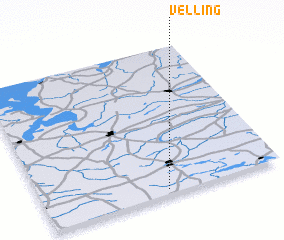 Places with similar names to Velling, Denmark ::
Disclaimer :: Information on this page comes without warranty of any kind |
||
|
Where is Velling? Elevation and coordinates ::
Latitude (lat): 56°2'0"N Longitude (lon): 9°31'0"E
Elevation (approx.): 104m (map arrows pan, magnifying glasses zoom) |
||
|
Visiting Velling? Hotel/Accommodation ::
Book a hotel in Velling Travel Guide ::
Buy a travel guide for Denmark rental cars ::
car rental offers GPS waypoint ::
download a GPX waypoint (PoI) of Velling for your GPS receiver
|
||