|
search place name
|
||
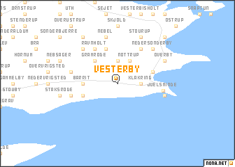
Vesterby (Vejle, Denmark)Vesterby is a town in the Vejle region of Denmark. An overview map of the region around Vesterby is displayed below.
regional and 3d topo map of Vesterby, Denmark ::
Vesterby airports ::
The nearest airport is ODE - Odense, located 35.9 km south east of Vesterby.
Other airports nearby include BLL - Billund (50.2 km west), SKS - Skrydstrup (69.8 km south west), AAR - Aarhus (77.2 km north east), KRP - Karup (82.7 km north west), Nearby towns ::
Klejsmølle (2.1km north west) //
Klakring (2.1km east) //
Klejs (3.7km north) //
Nøttrup (3.9km north) //
Gramrode (4.3km north west) //
Barrit (3.1km west) //
Asløkke (3.6km north east) //
Barritskov By (3.6km south west) //
Rårup (5.7km north) //
Ravnholt (5.9km north) //
Åstrup (5.9km north) //
Juelsminde (4.2km east) //
Nebel (7.5km north) //
Glattrup (7.5km north) //
Breth (4.6km north west) //
Barrithule (4.6km south west) //
Strandhuse (4.6km south east) //
Lindved (6.4km north west) //
Neder Sønderby (6.4km north east) //
Stourup (7.7km north) //
Overby (5.6km north east) //
Hosby (5.6km north east) //
Kirkholm (5.6km north east) //
Gram (8.0km north west) //
Sønderby (8.5km north east) //
[all distances 'as the bird flies' and approximate] 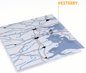 Places with similar names to Vesterby, Denmark ::
Disclaimer :: Information on this page comes without warranty of any kind |
||
|
Where is Vesterby? Elevation and coordinates ::
Latitude (lat): 55°43'0"N Longitude (lon): 9°57'0"E
Elevation (approx.): 49m (map arrows pan, magnifying glasses zoom) |
||
|
Visiting Vesterby? Hotel/Accommodation ::
Book a hotel in Vesterby Travel Guide ::
Buy a travel guide for Denmark rental cars ::
car rental offers GPS waypoint ::
download a GPX waypoint (PoI) of Vesterby for your GPS receiver
|
||