|
search place name
|
||
Vester Gasse (Sønderjylland, Denmark)Vester Gasse is a town in the Sønderjylland region of Denmark. An overview map of the region around Vester Gasse is displayed below.
regional and 3d topo map of Vester Gasse, Denmark ::

Vester Gasse airports ::
The nearest airport is SKS - Skrydstrup, located 30.7 km east of Vester Gasse.
Other airports nearby include GWT - Westerland Sylt (39.5 km south west), EBJ - Esbjerg (44.7 km north), SGD - Soenderborg Sonderborg (66.7 km east), BLL - Billund (69.4 km north), Nearby towns ::
Ullerup (1.9km north) //
Øster Gasse (2.1km east) //
Hjemsted (2.1km west) //
Skærbæk (2.1km west) //
Gesing (2.1km west) //
Vinum (3.9km south) //
Døstrup (3.9km south) //
Ottersbøl (2.8km south west) //
Åved (4.3km north east) //
Normsted (5.7km north) //
Mjolden (4.9km south west) //
Abterp (7.5km south) //
Birkelev (7.5km north) //
Haved (7.5km north) //
Nørre Vollum (7.5km south) //
Tevring (4.6km south east) //
Drengsted (6.4km south east) //
Frifelt (7.7km north) //
Brøns (5.6km north west) //
Vodder (8.1km north east) //
Gejlbjerg (7.0km north east) //
Randerup (8.5km south west) //
[all distances 'as the bird flies' and approximate] 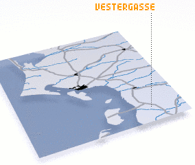 Places with similar names to Vester Gasse, Denmark ::
// Västra Ekås (SE)
// Västra Hyggås (SE)
Disclaimer :: Information on this page comes without warranty of any kind |
||
|
Where is Vester Gasse? Elevation and coordinates ::
Latitude (lat): 55°9'0"N Longitude (lon): 8°48'0"E
Elevation (approx.): 11m (map arrows pan, magnifying glasses zoom) |
||
|
Visiting Vester Gasse? Hotel/Accommodation ::
Book a hotel in Vester Gasse Travel Guide ::
Buy a travel guide for Denmark rental cars ::
car rental offers GPS waypoint ::
download a GPX waypoint (PoI) of Vester Gasse for your GPS receiver
|
||