|
search place name
|
||
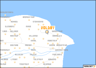
Voldby (Århus, Denmark)Voldby is a town in the Århus region of Denmark. An overview map of the region around Voldby is displayed below.
regional and 3d topo map of Voldby, Denmark ::
Voldby airports ::
The nearest airport is AAR - Aarhus, located 24.0 km south west of Voldby.
Other airports nearby include AAL - Aalborg (93.4 km north west), KRP - Karup (109.2 km west), ODE - Odense (115.2 km south), HAD - Halmstad (122.6 km east), Nearby towns ::
Karlby (1.9km north) //
Thorsø (2.1km south west) //
Sangstrup (2.0km east) //
Dolmer (3.7km south) //
Hammelev (2.8km south east) //
Gjerrild (3.8km north) //
Robstrup (3.8km south) //
Veggerslev (2.8km north west) //
Åstrup (4.2km south east) //
Stokkebro (4.2km north west) //
Grenå (5.7km south) //
Villersø (3.6km south west) //
Kirial (4.8km south west) //
Rimsø (4.5km north west) //
Skindbjerg (4.5km south west) //
Enslev (6.4km south west) //
Bredstrup (6.4km south east) //
Næsby (6.9km south west) //
Revn (8.0km south west) //
Grenå Strand (8.0km south east) //
Brøndstrup (6.9km north west) //
[all distances 'as the bird flies' and approximate] 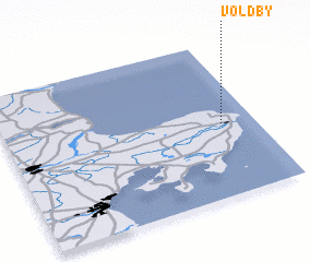 Places with similar names to Voldby, Denmark ::
// Vale de Boi (PT)
// Vale de Boi (PT)
// Vale do Boi (PT)
// Flatabø (NO)
// Flatabø (NO)
// Flateby (NO)
// Vall de Ebo (ES)
// Fūlād Bāghī (IR)
// Flat Bay (CA)
// Voldby (DK)
Disclaimer :: Information on this page comes without warranty of any kind |
||
|
Where is Voldby? Elevation and coordinates ::
Latitude (lat): 56°28'0"N Longitude (lon): 10°52'0"E
Elevation (approx.): 13m (map arrows pan, magnifying glasses zoom) |
||
|
Visiting Voldby? Hotel/Accommodation ::
Book a hotel in Voldby Travel Guide ::
Buy a travel guide for Denmark rental cars ::
car rental offers GPS waypoint ::
download a GPX waypoint (PoI) of Voldby for your GPS receiver
|
||