|
search place name
|
||
Brandenburg ((( Älvsborg )), Sweden)Brandenburg is a town in the (( Älvsborg )) region of Sweden. An overview map of the region around Brandenburg is displayed below.
regional and 3d topo map of Brandenburg, Sweden ::

Brandenburg airports ::
The nearest airport is GSE - Gothenborg Save, located 7.5 km south west of Brandenburg.
Other airports nearby include GOT - Gothenborg Landvetter (28.0 km south east), THN - Trollhattan Vanersborg (59.2 km north east), LDK - Lidkoping (101.5 km north east), HAD - Halmstad (138.0 km south east), Nearby towns ::
Slätten (1.0km west) //
Gullö (1.4km north west) //
Rödbo (1.4km north east) //
Djupedal (2.1km south east) //
Stubberöd (2.9km north) //
Näset (2.2km south west) //
Tunge (3.7km north) //
Gunnesby (2.7km south west) //
Säve (3.8km south) //
Svensby (3.8km south) //
Tega (2.7km north west) //
Ytterby (3.8km north) //
Hakered (2.7km north east) //
Lunna (2.7km north east) //
Kyrkeby (4.2km south west) //
Tolsered (4.2km south east) //
Kungälv (4.2km north east) //
Komarken (4.2km north east) //
Goddered (3.7km north east) //
Rollsbo (5.6km north) //
Ulvesund (3.0km west) //
Skändla (5.6km south) //
Brunstorp (3.5km south west) //
Ingebäck (3.5km south east) //
Munkegärde (5.6km north) //
Backer (3.5km north east) //
Bärby (5.9km south) //
Öxnäs (4.7km south west) //
Ängegärde (5.9km north) //
[all distances 'as the bird flies' and approximate] 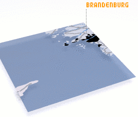 Places with similar names to Brandenburg, Sweden ::
// Brandenberg (AT)
// Brandenberg (AT)
// Brandenburg (US)
// Brandenberg (DE)
// Brandenberg (DE)
// Brandenberg (DE)
// Brandenburg (DE)
// Brandenburg (DE)
// Brandenburg (DE)
// Brandenbourg (LU)
Disclaimer :: Information on this page comes without warranty of any kind |
||
|
Where is Brandenburg? Elevation and coordinates ::
Latitude (lat): 57°50'0"N Longitude (lon): 11°56'0"E
Elevation (approx.): 93m (map arrows pan, magnifying glasses zoom) |
||
|
Visiting Brandenburg? Hotel/Accommodation ::
Book a hotel in Brandenburg Travel Guide ::
Buy a travel guide for Sweden rental cars ::
car rental offers GPS waypoint ::
download a GPX waypoint (PoI) of Brandenburg for your GPS receiver
|
||