|
search place name
|
||
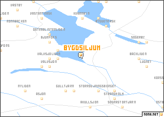
Bygdsiljum (Västerbotten, Sweden)Bygdsiljum is a town in the Västerbotten region of Sweden. An overview map of the region around Bygdsiljum is displayed below.
regional and 3d topo map of Bygdsiljum, Sweden ::
Bygdsiljum airports ::
The nearest airport is SFT - Skelleftea, located 40.5 km north east of Bygdsiljum.
Other airports nearby include UME - Umea (64.8 km south), LYC - Lycksele (87.4 km west), OER - Ornskoldsvik (129.6 km south west), AJR - Arvidsjaur (147.7 km north), Nearby towns ::
Högliden (1.9km north) //
Strandholm (2.4km west) //
Backvicken (3.0km north west) //
Välvsjöliden (3.2km west) //
Välvsjön (3.7km south west) //
Selsfors (7.5km south) //
Bjurfors (4.9km north west) //
Gulltjärn (7.6km south) //
Storrödjningsberget (7.6km south) //
Östra Blisterliden (6.4km north west) //
Bygdeträsk (7.8km north) //
Älglund (8.1km south east) //
[all distances 'as the bird flies' and approximate] 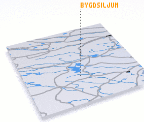 Places with similar names to Bygdsiljum, Sweden :: Disclaimer :: Information on this page comes without warranty of any kind |
||
|
Where is Bygdsiljum? Elevation and coordinates ::
Latitude (lat): 64°22'0"N Longitude (lon): 20°29'0"E
(map arrows pan, magnifying glasses zoom) |
||
|
Visiting Bygdsiljum? Hotel/Accommodation ::
Book a hotel in Bygdsiljum Travel Guide ::
Buy a travel guide for Sweden rental cars ::
car rental offers GPS waypoint ::
download a GPX waypoint (PoI) of Bygdsiljum for your GPS receiver
|
||