|
search place name
|
||
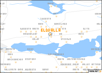
Eldvalla (Örebro, Sweden)Eldvalla is a town in the Örebro region of Sweden. An overview map of the region around Eldvalla is displayed below.
regional and 3d topo map of Eldvalla, Sweden ::
Eldvalla airports ::
The nearest airport is ORB - Orebro, located 23.1 km south west of Eldvalla.
Other airports nearby include KSK - Karlskoga (51.6 km west), VST - Vasteras (76.3 km north east), NRK - Norrkoeping Kungsangen (95.0 km south east), LPI - Linkoeping Saab (102.7 km south), Nearby towns ::
Skölv (0.0km north) //
Glanshammar (0.0km north) //
Via (1.9km east) //
Gränsjö (1.9km west) //
Krogesta (2.6km north east) //
Björka (2.6km north east) //
Äversta (2.6km north west) //
Berga (3.8km north) //
Skäcklinge (4.2km north east) //
Röne (4.2km north west) //
Balsna (4.2km north west) //
Nedergårda (2.8km west) //
Biverud (3.4km north east) //
Nasta (3.4km north west) //
Sticksjö (3.4km south east) //
Kolja (3.4km south west) //
Tjugesta (5.6km north) //
Ringkarleby (3.8km west) //
Hult (7.5km north) //
Mäjsta (4.2km north west) //
Hjälmarbaden (7.5km south) //
Ekeby (6.7km south west) //
[all distances 'as the bird flies' and approximate] 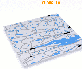 Places with similar names to Eldvalla, Sweden ::
Disclaimer :: Information on this page comes without warranty of any kind |
||
|
Where is Eldvalla? Elevation and coordinates ::
Latitude (lat): 59°19'0"N Longitude (lon): 15°24'0"E
Elevation (approx.): 39m (map arrows pan, magnifying glasses zoom) |
||
|
Visiting Eldvalla? Hotel/Accommodation ::
Book a hotel in Eldvalla Travel Guide ::
Buy a travel guide for Sweden rental cars ::
car rental offers GPS waypoint ::
download a GPX waypoint (PoI) of Eldvalla for your GPS receiver
|
||