|
search place name
|
||
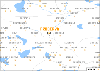
Fröderyd (Jönköping, Sweden)Fröderyd is a town in the Jönköping region of Sweden. An overview map of the region around Fröderyd is displayed below.
regional and 3d topo map of Fröderyd, Sweden ::
Fröderyd airports ::
The nearest airport is VXO - Vaxjo Kronoberg, located 44.0 km south of Fröderyd.
Other airports nearby include HLF - Hultsfred (62.0 km north east), JKG - Joenkoeping Jonkoping (68.5 km north west), OSK - Oskarshamn (98.3 km east), KLR - Kalkmar Kalmar (111.3 km south east), Nearby towns ::
Ljunganäs (1.9km north) //
Årset (1.9km south) //
Esprilla (2.0km east) //
Hökhult (3.7km south) //
Kallsjö (4.2km south west) //
Fröset (3.0km west) //
Broby (5.6km north) //
Landsbro (5.9km north) //
Huluboda (5.9km south) //
Knutstorp (7.4km south) //
Rulla (7.5km south) //
Bäckaby (6.3km south east) //
Rosenholm (5.5km north east) //
Slageryd (5.5km south east) //
Puketorp (7.7km south) //
[all distances 'as the bird flies' and approximate] 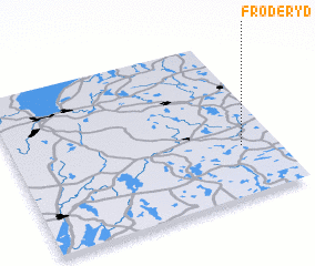 Places with similar names to Fröderyd, Sweden ::
// Fridritt (DE)
// Vorderreit (DE)
// Vorderreute (DE)
// Vorderreute (DE)
// Vorderreute (DE)
// Vorderried (DE)
// Vratarite (BG)
// Free Trade (US)
// Fairtraid (US)
// Fretterode (DE)
Disclaimer :: Information on this page comes without warranty of any kind |
||
|
Where is Fröderyd? Elevation and coordinates ::
Latitude (lat): 57°19'0"N Longitude (lon): 14°52'0"E
Elevation (approx.): 240m (map arrows pan, magnifying glasses zoom) |
||
|
Visiting Fröderyd? Hotel/Accommodation ::
Book a hotel in Fröderyd Travel Guide ::
Buy a travel guide for Sweden rental cars ::
car rental offers GPS waypoint ::
download a GPX waypoint (PoI) of Fröderyd for your GPS receiver
|
||