|
search place name
|
||
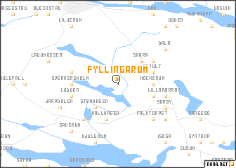
Fyllingarum (Östergötland, Sweden)Fyllingarum is a town in the Östergötland region of Sweden. An overview map of the region around Fyllingarum is displayed below.
regional and 3d topo map of Fyllingarum, Sweden ::
Fyllingarum airports ::
The nearest airport is NRK - Norrkoeping Kungsangen, located 25.7 km north of Fyllingarum.
Other airports nearby include LPI - Linkoeping Saab (41.3 km west), NYO - Stockholm Skavsta (56.2 km north east), HLF - Hultsfred (99.3 km south), OSK - Oskarshamn (113.4 km south), Nearby towns ::
Fröberga (4.2km north east) //
Skåra (4.2km north east) //
Stenhagen (4.2km south west) //
Höckerum (2.9km east) //
Frödetorp (3.4km south east) //
Dyhult (3.5km north east) //
Källhagen (5.6km south) //
Åskog (4.7km north east) //
Hälla (4.7km north east) //
Sverkersholm (3.9km west) //
Stora Viborg (4.3km north west) //
Ludden (4.3km south west) //
Lilla Norrby (4.3km south east) //
Falktorpet (6.3km south east) //
Mickelsdal (6.3km south west) //
Ringarum (5.4km south east) //
Sörby (5.4km south east) //
Dala (6.8km north east) //
Bråta (6.8km south east) //
Säverum (8.4km south west) //
[all distances 'as the bird flies' and approximate] 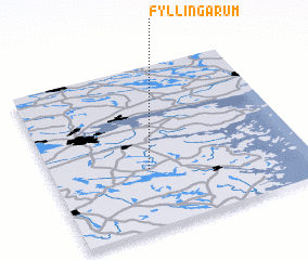 Places with similar names to Fyllingarum, Sweden ::
// Fulanikrom (GH)
Disclaimer :: Information on this page comes without warranty of any kind |
||
|
Where is Fyllingarum? Elevation and coordinates ::
Latitude (lat): 58°22'0"N Longitude (lon): 16°23'0"E
Elevation (approx.): 58m (map arrows pan, magnifying glasses zoom) |
||
|
Visiting Fyllingarum? Hotel/Accommodation ::
Book a hotel in Fyllingarum Travel Guide ::
Buy a travel guide for Sweden rental cars ::
car rental offers GPS waypoint ::
download a GPX waypoint (PoI) of Fyllingarum for your GPS receiver
|
||