|
search place name
|
||
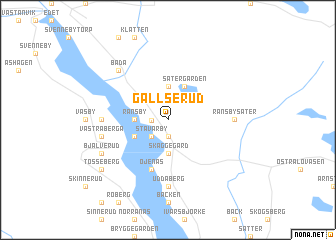
Gällserud (Värmland, Sweden)Gällserud is a town in the Värmland region of Sweden. An overview map of the region around Gällserud is displayed below.
regional and 3d topo map of Gällserud, Sweden ::
Gällserud airports ::
The nearest airport is KSK - Karlskoga, located 107.8 km south east of Gällserud.
Other airports nearby include MXX - Mora (127.3 km north east), ORB - Orebro (139.6 km south east), LDK - Lidkoping (174.7 km south), KVB - Skovde (181.8 km south), Nearby towns ::
Myringbyn (1.9km south) //
Bråten (0.9km west) //
Stävarby (2.1km south west) //
Lysvik (2.1km south west) //
Kyrkbyn (2.1km south west) //
Ransby (1.9km west) //
Backa (3.7km south) //
Åsegård (3.7km south) //
Skäggegård (3.7km south) //
Asp (3.7km north) //
Östra Berga (2.6km south west) //
Sätergården (3.8km north) //
Öjenäs (5.6km south) //
Uddaberg (7.4km south) //
Östra Kårud (7.4km south) //
Solberg (7.4km south) //
Ransbysäter (3.7km east) //
Gullsby (3.7km west) //
Västra Berga (4.1km south west) //
Råby (4.1km south west) //
Bada (6.2km north west) //
Bjälverud (5.2km south west) //
Tosseberg (6.7km south west) //
[all distances 'as the bird flies' and approximate] 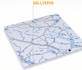 Places with similar names to Gällserud, Sweden ::
// Keilsried (DE)
// Gulsrud (NO)
// Kolsrud (NO)
// Kolsrud (NO)
// Kaliceret (ID)
// Galūzardū (IR)
// Gol-e Zard (IR)
// Gol-e Zard (IR)
// Gol-e Zard (IR)
// Gol-e Zard (IR)
Disclaimer :: Information on this page comes without warranty of any kind |
||
|
Where is Gällserud? Elevation and coordinates ::
Latitude (lat): 60°2'0"N Longitude (lon): 13°9'0"E
(map arrows pan, magnifying glasses zoom) |
||
|
Visiting Gällserud? Hotel/Accommodation ::
Book a hotel in Gällserud Travel Guide ::
Buy a travel guide for Sweden rental cars ::
car rental offers GPS waypoint ::
download a GPX waypoint (PoI) of Gällserud for your GPS receiver
|
||