|
search place name
|
||
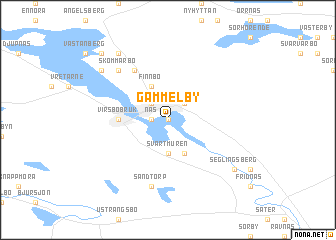
Gammelby (Västmanland, Sweden)Gammelby is a town in the Västmanland region of Sweden. An overview map of the region around Gammelby is displayed below.
regional and 3d topo map of Gammelby, Sweden ::
Gammelby airports ::
The nearest airport is VST - Vasteras, located 43.7 km south east of Gammelby.
Other airports nearby include BLE - Borlange (69.5 km north west), ORB - Orebro (92.9 km south west), GVX - Gavle (94.2 km north east), ARN - Stockholm Arlanda (105.9 km east), Nearby towns ::
Muggbo (0.0km north) //
Näs (0.9km west) //
Nordanö (2.1km north west) //
Ingelstorp (2.1km north east) //
Svartmuren (3.7km south) //
Finnbo (3.8km north) //
Heden (3.8km south) //
Virsbo Bruk (2.8km west) //
Österäng (5.9km north) //
Melfallet (5.9km north) //
Östra Mursjön (5.9km north) //
Sandtorp (7.5km south) //
Skommarbo (6.2km north west) //
Bondfallet (7.9km north) //
Prästtorpet (6.7km north west) //
Seglingsberg (6.7km south east) //
Sörby (8.3km north west) //
[all distances 'as the bird flies' and approximate] 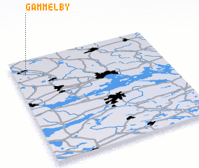 Places with similar names to Gammelby, Sweden ::
// Gammelby (DE)
// Kâmiloba (TR)
// Ga-Mohlabe (ZA)
// Ka-Mulaba (ZA)
// Kamulaba (UG)
// Kamīlāb (SD)
// Kamīlāb (SD)
// Kambalayba (GM)
// Komalabu (PG)
// Cambuul Lebi (SO)
Disclaimer :: Information on this page comes without warranty of any kind |
||
|
Where is Gammelby? Elevation and coordinates ::
Latitude (lat): 59°52'0"N Longitude (lon): 16°5'0"E
Elevation (approx.): 88m (map arrows pan, magnifying glasses zoom) |
||
|
Visiting Gammelby? Hotel/Accommodation ::
Book a hotel in Gammelby Travel Guide ::
Buy a travel guide for Sweden rental cars ::
car rental offers GPS waypoint ::
download a GPX waypoint (PoI) of Gammelby for your GPS receiver
|
||