|
search place name
|
||
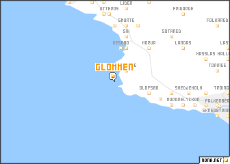
Glommen (Halland, Sweden)Glommen is a town in the Halland region of Sweden. An overview map of the region around Glommen is displayed below.
regional and 3d topo map of Glommen, Sweden ::
nearby GPS traces from timatio ::
Glommen airports ::
The nearest airport is HAD - Halmstad, located 39.4 km south east of Glommen.
Other airports nearby include GOT - Gothenborg Landvetter (81.4 km north), GSE - Gothenborg Save (98.0 km north), JLD - Landskrona (114.7 km south), AAR - Aarhus (127.5 km south west), Nearby towns ::
Digesgård (2.1km north east) //
Lönestig (2.1km north east) //
Kesebo (5.6km north) //
Agerör (3.6km south east) //
Olofsbo (3.6km south east) //
Grytås (5.7km north) //
Sik (7.5km north) //
Morup (6.3km north east) //
Holmarör (4.9km south east) //
[all distances 'as the bird flies' and approximate] 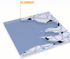 Places with similar names to Glommen, Sweden ::
Disclaimer :: Information on this page comes without warranty of any kind |
||
|
Where is Glommen? Elevation and coordinates ::
Latitude (lat): 56°56'0"N Longitude (lon): 12°21'0"E
Elevation (approx.): -32768m (map arrows pan, magnifying glasses zoom) |
||
|
Visiting Glommen? Hotel/Accommodation ::
Book a hotel in Glommen Travel Guide ::
Buy a travel guide for Sweden rental cars ::
car rental offers GPS waypoint ::
download a GPX waypoint (PoI) of Glommen for your GPS receiver
|
||