|
search place name
|
||
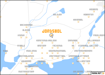
Jordsbol (Värmland, Sweden)Jordsbol is a town in the Värmland region of Sweden. An overview map of the region around Jordsbol is displayed below.
regional and 3d topo map of Jordsbol, Sweden ::
Jordsbol airports ::
The nearest airport is KSK - Karlskoga, located 27.1 km north east of Jordsbol.
Other airports nearby include ORB - Orebro (45.2 km east), KVB - Skovde (77.3 km south), LDK - Lidkoping (97.6 km south west), LPI - Linkoeping Saab (115.1 km south east), Nearby towns ::
Väglösa (1.9km south) //
Skottlanda (3.7km south) //
Tackerud (3.8km south) //
Konsterud (2.7km south west) //
Brotorp (4.2km south west) //
Björkebol (5.6km south) //
Norra Undersbol (5.6km south) //
Södra Undersbol (5.6km south) //
Kolerud (5.6km south) //
Linnevalstorp (5.9km south) //
Frosterud (5.9km south) //
Runnebol (7.4km south) //
Västra Gottbol (7.5km south) //
Persbol (7.5km south) //
Gärdsbol (4.2km south east) //
Sälsjön (7.5km north) //
Mo (5.3km south east) //
Revsten (7.7km south) //
Östra Gottbol (7.7km south) //
Norra Ugglebol (7.7km south) //
Ingelsrud (6.7km south west) //
Grannäs (8.3km south east) //
Östra Bjurvik (8.3km south west) //
[all distances 'as the bird flies' and approximate] 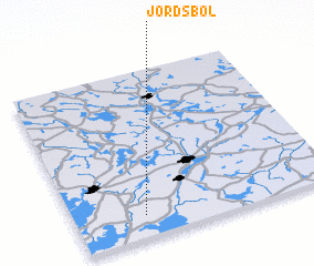 Places with similar names to Jordsbol, Sweden ::
// Hjortsballe (DK)
// Hjortsballe (DK)
Disclaimer :: Information on this page comes without warranty of any kind |
||
|
Where is Jordsbol? Elevation and coordinates ::
Latitude (lat): 59°8'0"N Longitude (lon): 14°16'0"E
Elevation (approx.): 122m (map arrows pan, magnifying glasses zoom) |
||
|
Visiting Jordsbol? Hotel/Accommodation ::
Book a hotel in Jordsbol Travel Guide ::
Buy a travel guide for Sweden rental cars ::
car rental offers GPS waypoint ::
download a GPX waypoint (PoI) of Jordsbol for your GPS receiver
|
||