|
search place name
|
||
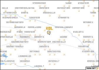
Köl (Kalmar, Sweden)Köl is a town in the Kalmar region of Sweden. An overview map of the region around Köl is displayed below.
regional and 3d topo map of Köl, Sweden ::
Köl airports ::
The nearest airport is KLR - Kalkmar Kalmar, located 19.0 km east of Köl.
Other airports nearby include RNB - Ronneby (70.3 km south west), OSK - Oskarshamn (73.4 km north east), VXO - Vaxjo Kronoberg (80.2 km west), HLF - Hultsfred (87.1 km north), Nearby towns ::
Högebo (2.1km north west) //
Persmåla (2.0km west) //
Fjälebo (2.8km south east) //
Börseryd (2.8km south west) //
Överstatorp (3.8km south) //
Västrakulla (4.2km south east) //
Bosgård (5.6km south) //
Södra Ljusås (3.0km west) //
Gårdsryd (5.7km south) //
Hanemåla (3.6km south west) //
Kristvallabrunn (3.6km north east) //
Norra Ljusås (3.6km north west) //
Uddabo (3.6km south east) //
Kulla (7.4km south) //
Räggekulla (7.4km north) //
Transtorp (4.1km west) //
Sankt Sigfrid (7.5km south) //
Stämmeryd (6.3km north east) //
Torestorp (6.3km north west) //
Kristvalla (7.7km north) //
Duvetorp (7.7km north) //
Förebo (7.7km south) //
Markustorp (6.9km north west) //
Brändebo (8.0km south) //
Nättrabo (8.0km south) //
Lisabo (8.0km south) //
[all distances 'as the bird flies' and approximate] 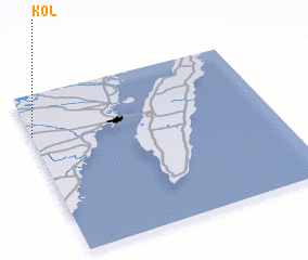 Places with similar names to Köl, Sweden ::
Disclaimer :: Information on this page comes without warranty of any kind |
||
|
Where is Köl? Elevation and coordinates ::
Latitude (lat): 56°45'0"N Longitude (lon): 16°0'0"E
Elevation (approx.): 76m (map arrows pan, magnifying glasses zoom) |
||
|
Visiting Köl? Hotel/Accommodation ::
Book a hotel in Köl Travel Guide ::
Buy a travel guide for Sweden rental cars ::
car rental offers GPS waypoint ::
download a GPX waypoint (PoI) of Köl for your GPS receiver
|
||